La Galandrure
La Galandrure is a locality in Les Planchettes, La Chaux-de-Fonds District, Canton of Neuchâtel. La Galandrure is situated nearby to the locality Le Basset, as well as near La Sagne-Pendante.| Tap on a place to explore it |
Places of Interest
Highlights include Les Eplatures Airport and Reformed Church.
Les Eplatures Airport
Aerodrome

Photo: Carsten Steger, CC BY-SA 4.0.
Les Éplatures Airport is a small international airport near La Chaux-de-Fonds, Switzerland. The airport primarily caters to executive and recreational flying, with some air taxi and charter service. Les Eplatures Airport is situated 2½ km east of La Galandrure.

Saut du Doubs
Waterfall
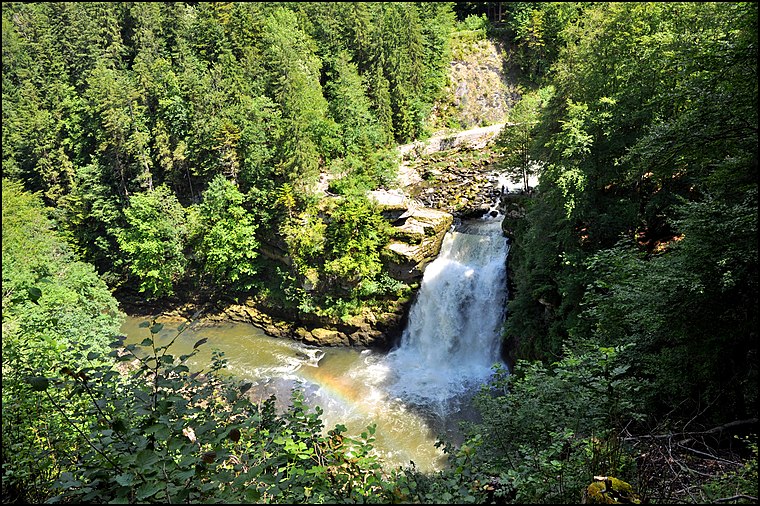
Photo: Wikimedia, CC BY-SA 2.0.
Saut du Doubs is a waterfall, which is situated 3½ km west of La Galandrure.
Places in the Area
Nearby places include Quartier-Neuf and Les Éplatures.
Quartier-Neuf
Neighborhood

Photo: Wikimedia, Public domain.
Quartier-Neuf is a neighborhood, which is situated 3½ km south of La Galandrure.
Les Éplatures
Neighborhood
Photo: Carsten Steger, CC BY-SA 4.0.
Les Éplatures is a neighborhood, which is situated 3½ km east of La Galandrure.
Le Locle
 Le Locle is the one of two big cities in the mountain region of the canton of Neuchâte in Switzerland. Often dubbed "town of precision", the city has an impressive heritage of watch making and has been inscribed in the UNESCO World Heritage List as "La Chaux-de-Fonds / Le Locle, Watchmaking Town Planning".
La Galandrure
Latitude
47.09212° or 47° 5′ 32″ northLongitude
6.75943° or 6° 45′ 34″ eastOpen location code
8FV83QR5+RQOpenStreetMap ID
node 11821867922OpenStreetMap feature
place=locality
This page is based on OpenStreetMap, Wikidata, and Wikimedia Commons.
We’d love your help improving our open data sources. Thank you for contributing.
Satellite Map
Discover La Galandrure from above in high-definition satellite imagery.
Places with the Same Name
Discover other places named “La Galandrure”.
Localities in the Area
Explore places such as Le Basset and La Sagne-Pendante.
Notable Places Nearby
Highlights include Belvedere du CAS and Belvedere L Escarpineau.
Switzerland: Must-Visit Destinations
Delve into Zurich, Berne, Geneva, and Basel.
Curious Localities to Discover
Uncover intriguing localities from every corner of the globe.
About Mapcarta. Data © OpenStreetMap contributors and available under the Open Database License". Text is available under the CC BY-SA 4.0 license, except for photos, directions, and the map. Photo: Simonizer, CC BY-SA 2.0 de.