FITcooling
FITcooling is a health club in Baden-Württemberg, Germany which is located on Besigheimer Straße. FITcooling is situated nearby to the church Königreichssaal, as well as near Martin-Luther-Kirche.| Tap on a place to explore it |
Places of Interest Nearby
Highlights include Martin-Luther-Kirche and Kreuzkirche.
Martin-Luther-Kirche
Church

Photo: Wikimedia, CC BY-SA 2.5.
Martin-Luther-Kirche is a church, which is situated 370 metres southeast of FITcooling.
Kreuzkirche
Church

Photo: Wikimedia, CC BY-SA 3.0.
Kreuzkirche is a church, which is situated 480 metres west of FITcooling.
Frankenstadion Heilbronn
Stadium
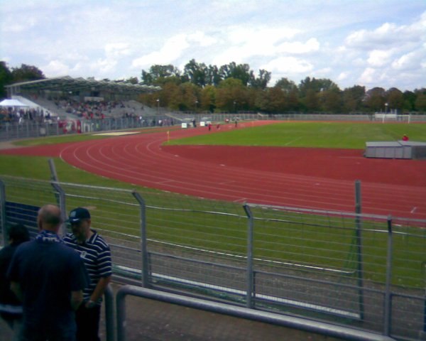
Photo: Ampfinger, CC BY-SA 3.0.
Frankenstadion Heilbronn is a multi-use stadium in Heilbronn, Germany. It is currently used mostly for football matches and is the home stadium of FC Heilbronn. The stadium is able to hold 17,200 people. Frankenstadion Heilbronn is situated 1 km northwest of FITcooling.
Places in the Area
Nearby places include Heilbronn and Sontheim.
Heilbronn

Photo: Nastoshka, CC BY-SA 3.0.
Heilbronn is a city in northern Baden-Württemberg, Germany, surrounded by the Heilbronn District. From the late Middle Ages on, it developed into an important trading centre.

Badener Hof
Neighborhood

Photo: Rosenzweig, CC BY-SA 3.0.
Badener Hof is a neighborhood, which is situated 3 km east of FITcooling.
FITcooling
- Type: Health club
- Address: Besigheimer Straße 52, Heilbronn, 74074
- Categories: recreation area and sports location
- Location: Baden-Württemberg, Germany, Central Europe, Europe
- View on OpenStreetMap
Latitude
49.12937° or 49° 7′ 46″ northLongitude
9.21156° or 9° 12′ 42″ eastOpen location code
8FXF46H6+PJOpenStreetMap ID
node 11822044459OpenStreetMap feature
leisure=fitness_centre
This page is based on OpenStreetMap, Wikidata, and Wikimedia Commons.
We’d love your help improving our open data sources. Thank you for contributing.
Satellite Map
Discover FITcooling from above in high-definition satellite imagery.
Notable Places Nearby
Highlights include Königreichssaal and Integrierte Leitstelle Heilbronn.
Nearby Places
Explore places such as ABD Auto Reparatur Service and Hairlights Studio.
Baden-Württemberg: Must-Visit Destinations
Delve into Stuttgart, Heidelberg, Karlsruhe, and Mannheim.
Curious Health Clubs to Discover
Uncover intriguing health clubs from every corner of the globe.
About Mapcarta. Data © OpenStreetMap contributors and available under the Open Database License". Text is available under the CC BY-SA 4.0 license, except for photos, directions, and the map. Photo: Traveler100, CC BY-SA 3.0.