Fjord-Centret i Udbyhøj
Fjord-Centret i Udbyhøj is in Randers, Central Jutland. Fjord-Centret i Udbyhøj is situated nearby to the marina Udbyhøj Lystbådehavn, as well as near the pier Kommandobroen.| Tap on a place to explore it |
Places of Interest Nearby
Highlights include Sødringholm and Sødring Church.
Sødringholm
Manor estate

Photo: Nico, CC BY-SA 4.0.
Sødringholm is a manor estate, which is situated 1½ km north of Fjord-Centret i Udbyhøj.
Sødring Church
Church
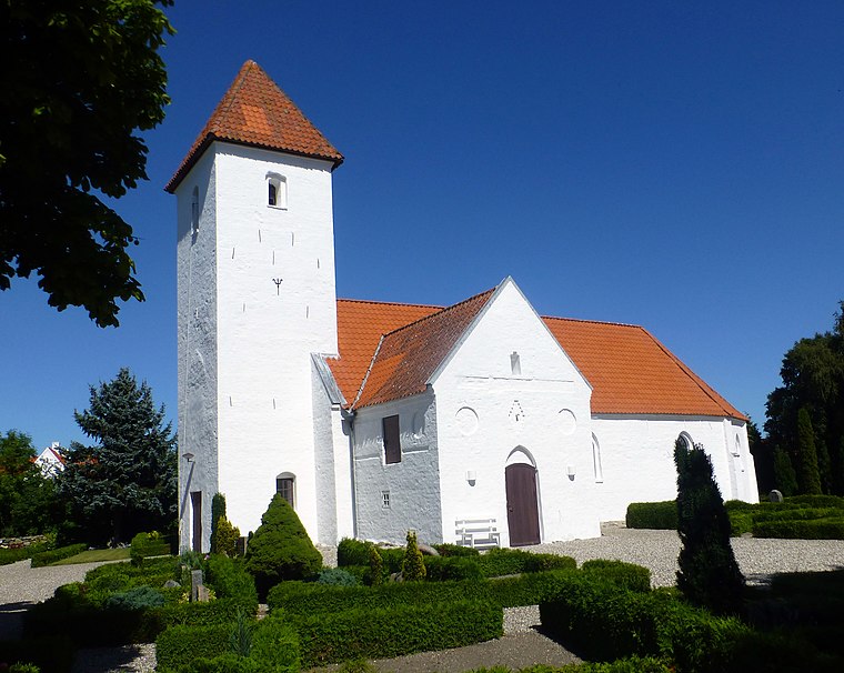
Photo: Nico, CC BY-SA 4.0.
Sødring Church is situated 1½ km north of Fjord-Centret i Udbyhøj.
Places in the Area
Nearby places include Dalbyover and Holbæk.
Dalbyover
Village

Photo: Beethoven9, CC BY-SA 4.0.
Dalbyover is a village, which is situated 7 km west of Fjord-Centret i Udbyhøj.
Holbæk
Village

Photo: Jan Friberg, CC BY 2.5.
Holbæk is a village, which is situated 7 km south of Fjord-Centret i Udbyhøj.
Havndal
Village

Photo: Beethoven9, CC BY-SA 4.0.
Havndal is a village, which is situated 8 km northwest of Fjord-Centret i Udbyhøj.
Fjord-Centret i Udbyhøj
- Type: Tourism
- Category: tourist attraction
- Location: Randers, Central Jutland, Denmark, Nordic countries, Europe
- View on OpenStreetMap
Latitude
56.61578° or 56° 36′ 57″ northLongitude
10.3141° or 10° 18′ 51″ eastOpen location code
9F8GJ887+8JOpenStreetMap ID
node 11826203357OpenStreetMap feature
tourism=lean_to
This page is based on OpenStreetMap, Wikidata, and Wikimedia Commons.
We’d love your help improving our open data sources. Thank you for contributing.
Satellite Map
Discover Fjord-Centret i Udbyhøj from above in high-definition satellite imagery.
Notable Places Nearby
Highlights include Udbyhøj Lystbådehavn and Kommandobroen.
Nearby Places
Explore places such as Shelterplads ved Fjord-Centret i Udbyhøj and Hav&Fjord.
Denmark: Must-Visit Destinations
Delve into Copenhagen, Aarhus, Odense, and Aalborg.
Curious Places to Discover
Uncover intriguing places from every corner of the globe.
About Mapcarta. Data © OpenStreetMap contributors and available under the Open Database License". Text is available under the CC BY-SA 4.0 license, except for photos, directions, and the map. Photo: Nico-dk, CC BY-SA 3.0.