The Owl’s Nest
The Owl’s Nest is a community center in Clark, Nevada. The Owl’s Nest is situated nearby to the amusement arcade Flight Simulators, as well as near the health club Predator Fitness Center.| Tap on a place to explore it |
Places of Interest Nearby
Highlights include Creech Air Force Base and Indian Springs Pass.
Creech Air Force Base
Aerodrome
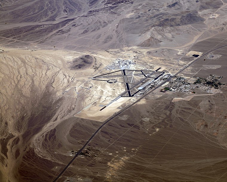
Photo: Doc Searls, CC BY 2.0.
Creech Air Force Base is a United States Air Force command and control facility in Clark County, Nevada used "to engage in daily Overseas Contingency Operations …of remotely piloted aircraft systems which fly missions across the globe." In addition…
Indian Springs Pass
Mountain saddle
Indian Springs Pass, is a mountain pass 40-mi northwest of Las Vegas in northwest Clark County, Nevada. The pass is in a region of converging landforms of various watersheds, valleys, and mountain ranges; specifically it lies on the north perimeter of the Ivanpah-Pahrump Watershed-.
Places in the Area
Nearby places include Indian Springs.
Indian Springs
Village

Photo: Stan Shebs, CC BY-SA 3.0.
Indian Springs is an unincorporated town and a census-designated place located on U.S. Route 95 next to Creech Air Force Base in northwestern Clark County and southern Nevada. The population was 912 at the 2020 census.
The Owl’s Nest
- Opening hours: 24/7
- Type: Community center
- Location: Clark, Nevada, Southwest, United States, North America
- View on OpenStreetMap
Latitude
36.59304° or 36° 35′ 35″ northLongitude
-115.65845° or 115° 39′ 30″ westOperator
US Air ForceOpen location code
8586H8VR+6JOpenStreetMap ID
node 11861004093OpenStreetMap feature
amenity=community_centre
This page is based on OpenStreetMap, Wikidata, and Wikimedia Commons.
We’d love your help improving our open data sources. Thank you for contributing.
Satellite Map
Discover The Owl’s Nest from above in high-definition satellite imagery.
Places with the Same Name
Discover other places named “The Owl’s Nest”.
Notable Places Nearby
Highlights include Flight Simulators and Predator Fitness Center.
Nearby Places
Explore places such as Guardian Dining Facility and Wing HQ.
Nevada: Must-Visit Destinations
Delve into Las Vegas, Carson City, Reno, and Henderson and East.
Curious Community Centers to Discover
Uncover intriguing community centers from every corner of the globe.
About Mapcarta. Data © OpenStreetMap contributors and available under the Open Database License". Text is available under the CC BY-SA 4.0 license, except for photos, directions, and the map. Photo: exothermic, CC BY 2.0.