Gedenkstein Guter Born
Gedenkstein Guter Born is a memorial in Griesheim, Darmstadt-Dieburg, Hesse. Gedenkstein Guter Born is situated nearby to the forest Goller Wäldchen, as well as near the nature reserve Griesheimer Düne und Eichwäldchen.| Tap on a place to explore it |
Places of Interest Nearby
Highlights include Griesheimer Düne und Eichwäldchen and Protestant Church.
Griesheimer Düne und Eichwäldchen
Nature reserve
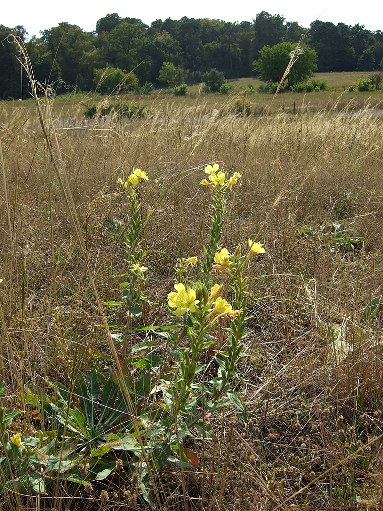
Photo: Thiotrix, CC BY-SA 3.0.
Griesheimer Düne und Eichwäldchen is a nature reserve.
Protestant Church
Church

Photo: Hewiha, CC BY-SA 4.0.
Protestant Church is situated 2½ km southeast of Gedenkstein Guter Born.
Dagger Complex
Military installation

Photo: Kuebi, CC BY-SA 3.0.
The Dagger Complex is a US military base in Darmstadt, close to Griesheim and located at the Eberstädter Weg, south of the August-Euler-Airfield. The complex is under US Army Intelligence and Security Command command on behalf of the US National Security Agency and is officially known as Subunit 1 operated by USMC G Company. Dagger Complex is situated 3½ km northeast of Gedenkstein Guter Born.
Places in the Area
Nearby places include St.-Barbara-Siedlung and Darmstadt-Eberstadt.
St.-Barbara-Siedlung
Neighborhood

Photo: Jolly Lobster, CC BY-SA 4.0.
St.-Barbara-Siedlung is a neighborhood, which is situated 7 km east of Gedenkstein Guter Born.
Darmstadt-Eberstadt
Suburb

Photo: Bin im Garten, CC BY-SA 3.0.
Eberstadt is the southernmost borough of Darmstadt in Hessen, Germany with a population of 23,728. Darmstadt-Eberstadt is situated 7 km east of Gedenkstein Guter Born.
Büttelborn
Village

Photo: AlexanderKlink, CC BY 3.0.
Büttelborn is a municipality in Groß-Gerau district in Hesse, Germany. Büttelborn is situated 8 km north of Gedenkstein Guter Born.
Gedenkstein Guter Born
- Type: Memorial
- Category: historic site
- Location: Griesheim, Darmstadt-Dieburg, South Hesse, Hesse, Germany, Central Europe, Europe
- View on OpenStreetMap
Latitude
49.82941° or 49° 49′ 46″ northLongitude
8.54378° or 8° 32′ 38″ eastOpen location code
8FXCRGHV+QGOpenStreetMap ID
node 11874334758OpenStreetMap feature
historic=memorial
This page is based on OpenStreetMap, Wikidata, and Wikimedia Commons.
We’d love your help improving our open data sources. Thank you for contributing.
Satellite Map
Discover Gedenkstein Guter Born from above in high-definition satellite imagery.
Notable Places Nearby
Highlights include Goller Wäldchen and Waschkieswerk Crumstadt GmbH & Co.KG.
Nearby Places
Explore places such as Grillhütte Odenwaldclub and Solarpark Griesheim.
South Hesse: Must-Visit Destinations
Delve into Darmstadt, Bensheim, Lorsch, and Heppenheim.
Curious Memorials to Discover
Uncover intriguing memorials from every corner of the globe.
About Mapcarta. Data © OpenStreetMap contributors and available under the Open Database License". Text is available under the CC BY-SA 4.0 license, except for photos, directions, and the map. Photo: Mylius, GFDL.