Betsäulenrest
Betsäulenrest is a wayside shrine in Sangerhausen, Mansfeld-Südharz, Saxony-Anhalt. Betsäulenrest is situated nearby to the park Schützenplatz, as well as near the health club X Sports.| Tap on a place to explore it |
Places of Interest Nearby
Highlights include Jacobikirche and Rathaus Sangerhausen.
Jacobikirche
Church

Photo: MOdmate, CC BY-SA 3.0.
Jacobikirche is a church, which is situated 340 metres northeast of Betsäulenrest.
Rathaus Sangerhausen
Town hall
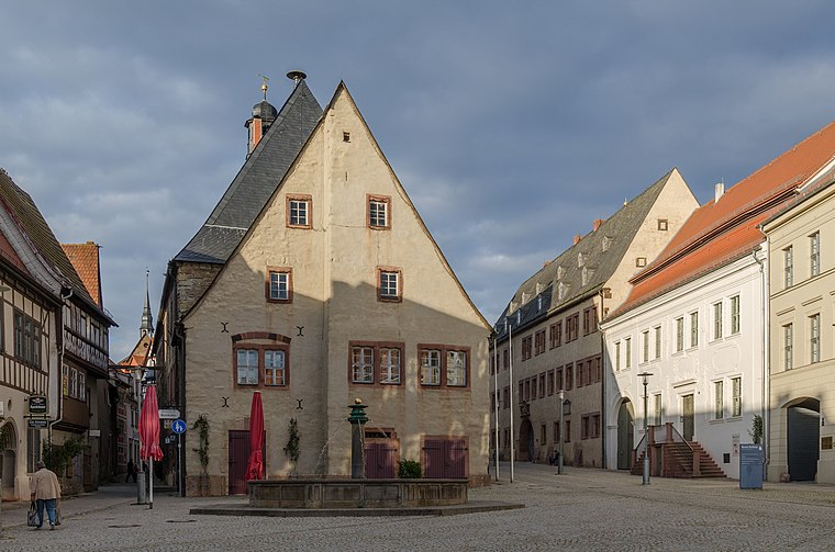
Photo: Tilman2007, CC BY-SA 3.0.
Rathaus Sangerhausen is a town hall, which is situated 470 metres northeast of Betsäulenrest.
Amtsgericht Sangerhausen, neues Schloss
Courthouse

Photo: Giorno2, CC BY-SA 4.0.
Amtsgericht Sangerhausen, neues Schloss is a courthouse, which is situated 480 metres east of Betsäulenrest.
Places in the Area
Nearby places include Sangerhausen and Lengefeld.
Sangerhausen
Town

Photo: Наталия19, CC BY-SA 3.0.
Sangerhausen is a town in Saxony-Anhalt, central Germany, capital of the district of Mansfeld-Südharz. It is situated southeast of the Harz, approx. 35 kilometres east of Nordhausen, and 50 km west of Halle. About 26,000 people live in Sangerhausen.
Lengefeld
Village

Photo: B.Thomas95, CC BY-SA 4.0.
Lengefeld is a village, which is situated 4 km northwest of Betsäulenrest.
Gonna
Village

Photo: Jwaller, CC BY-SA 4.0.
Gonna is a village, which is situated 4½ km northeast of Betsäulenrest.
Betsäulenrest
- Type: Wayside shrine
- Category: historic site
- Location: Sangerhausen, Mansfeld-Südharz, Saxony-Anhalt, Germany, Central Europe, Europe
- View on OpenStreetMap
Latitude
51.47143° or 51° 28′ 17″ northLongitude
11.29288° or 11° 17′ 34″ eastOpen location code
9F3HF7CV+H5OpenStreetMap ID
node 1187646862OpenStreetMap feature
historic=wayside_shrine
This page is based on OpenStreetMap, Wikidata, and Wikimedia Commons.
We’d love your help improving our open data sources. Thank you for contributing.
Satellite Map
Discover Betsäulenrest from above in high-definition satellite imagery.
Places with the Same Name
Discover other places named “Betsäulenrest”.
Notable Places Nearby
Highlights include Schützenplatz and X Sports.
Nearby Places
Explore places such as Steinkreuz and Stift St. Spiritus.
Saxony-Anhalt: Must-Visit Destinations
Delve into Magdeburg, Halle, Wittenberg, and Quedlinburg.
Curious Wayside Shrines to Discover
Uncover intriguing wayside shrines from every corner of the globe.
About Mapcarta. Data © OpenStreetMap contributors and available under the Open Database License". Text is available under the CC BY-SA 4.0 license, except for photos, directions, and the map. Photo: GMM, Public domain.