Brostedet
Brostedet is a slipway in Randers, Central Jutland. Brostedet is situated nearby to the runestone Ålumstenene, as well as near Ålum Church.| Tap on a place to explore it |
Places of Interest Nearby
Highlights include Ålum Church and Vester Velling Church.
Ålum Church
Church

Photo: Calvin, CC BY-SA 3.0.
Ålum Church is situated 360 metres north of Brostedet.
Vester Velling Church
Church
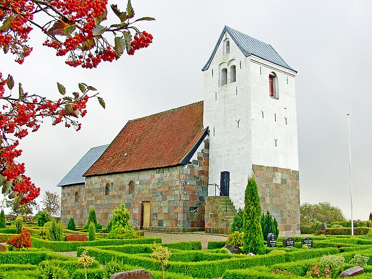
Photo: Bococo, CC BY-SA 3.0.
Vester Velling Church is situated 2 km south of Brostedet.
Fussingø
Manor estate

Photo: Nico-dk, CC BY-SA 3.0.
Fussingø is a manor estate, which is situated 3 km north of Brostedet.
Places in the Area
Nearby places include Læsten and Sønderbæk.
Læsten
Hamlet

Photo: Beethoven9, CC BY-SA 4.0.
Læsten is a hamlet, which is situated 5 km north of Brostedet.
Sønderbæk
Village

Photo: Beethoven9, CC BY-SA 4.0.
Sønderbæk is a village, which is situated 6 km north of Brostedet.
Øster Bjerregrav
Village

Photo: Bococo, CC BY-SA 3.0.
Øster Bjerregrav is a small town, with a population of 1,024, in Randers Municipality, Central Denmark Region in Denmark. It is situated just northeast of Fussing Sø, 8 km west of Randers and 33 km east of Viborg. Øster Bjerregrav is situated 6 km northeast of Brostedet.
Brostedet
- Type: Slipway
- Categories: recreation area and transportation
- Location: Randers, Central Jutland, Denmark, Nordic countries, Europe
- View on OpenStreetMap
Latitude
56.44926° or 56° 26′ 57″ northLongitude
9.83175° or 9° 49′ 54″ eastOpen location code
9F8FCRXJ+PPOpenStreetMap ID
node 11922131778OpenStreetMap feature
leisure=slipwayOpenStreetMap feature
waterway=access_point
This page is based on OpenStreetMap, Wikidata, and Wikimedia Commons.
We’d love your help improving our open data sources. Thank you for contributing.
Satellite Map
Discover Brostedet from above in high-definition satellite imagery.
Notable Places Nearby
Highlights include Ålumstenene and Ålum Forsamlingshus.
Nearby Places
Explore places such as Brostedet Shelterplads and Brohuset.
Denmark: Must-Visit Destinations
Delve into Copenhagen, Aarhus, Odense, and Aalborg.
Curious Slipways to Discover
Uncover intriguing slipways from every corner of the globe.
About Mapcarta. Data © OpenStreetMap contributors and available under the Open Database License". Text is available under the CC BY-SA 4.0 license, except for photos, directions, and the map. Photo: Nico-dk, CC BY-SA 3.0.