Fotografdd
Fotografdd is a photographer in Dresden, Saxon Elbland, Saxony. Fotografdd is situated nearby to the recreation area Bärenhecke, as well as near the sports venue Sporthalle 25. Grund- und 25. Oberschule.| Tap on a place to explore it |
- Opening hours: Monday, Wednesday, and Friday 10:00 AM—5:00 PM
- Type: Photographer
- Wheelchair access: no
Places of Interest Nearby
Highlights include Technische Sammlungen Dresden and Ernemannturm.
Technische Sammlungen Dresden
Museum

Photo: Don-kun, CC BY-SA 3.0.
Technische Sammlungen Dresden is a museum, which is situated 320 metres southeast of Fotografdd.
Ernemannturm
Scenic viewpoint

Photo: Wikimedia, CC BY-SA 4.0.
Ernemannturm is a scenic viewpoint, which is situated 300 metres southeast of Fotografdd.
Mariä Himmelfahrt
Church

Photo: Paulae, CC BY-SA 3.0.
Mariä Himmelfahrt is a church, which is situated 210 metres east of Fotografdd.
Places in the Area
Nearby places include Striesen and GEWOBAG-Siedlung (Dresden).

GEWOBAG-Siedlung (Dresden)
Neighborhood

Photo: Paulae, CC BY-SA 3.0.
GEWOBAG-Siedlung (Dresden) is a neighborhood.
Blasewitz
Suburb
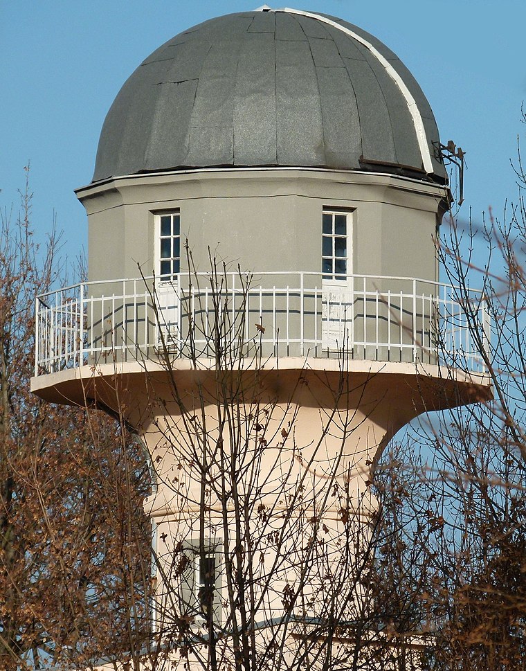
Photo: Brücke-Osteuropa, CC0.
Blasewitz is a larger borough of Dresden, Germany in the city's eastern centre on the Elbe river. It consists of seven quarters : Blasewitz is connected to the borough of Loschwitz north of the river Elbe by the Blue Wonder bridge, Johannstadt to the west, Striesen to the south, and Tolkewitz to the east.
Fotografdd
- Category: workshop
- Location: Dresden, Saxon Elbland, Saxony, Germany, Central Europe, Europe
- View on OpenStreetMap
Latitude
51.04385° or 51° 2′ 38″ northLongitude
13.79453° or 13° 47′ 40″ eastOperator
Andreas KeckOpen location code
9F3M2QVV+GROpenStreetMap ID
node 11929289214OpenStreetMap feature
craft=photographerOpenStreetMap attribute
wheelchair=no
This page is based on OpenStreetMap, Wikidata, and Wikimedia Commons.
We’d love your help improving our open data sources. Thank you for contributing.
Satellite Map
Discover Fotografdd from above in high-definition satellite imagery.
Notable Places Nearby
Highlights include Bärenhecke and Sporthalle 25. Grund- und 25. Oberschule.
Nearby Places
Explore places such as Feinbäckerei Kallenbach and Zahnarzt Hanisch.
Saxon Elbland: Must-Visit Destinations
Delve into Meißen, Riesa, Radebeul, and Freital.
Curious Photographers to Discover
Uncover intriguing photographers from every corner of the globe.
About Mapcarta. Data © OpenStreetMap contributors and available under the Open Database License". Text is available under the CC BY-SA 4.0 license, except for photos, directions, and the map. Photo: Kreidefossil, CC BY-SA 3.0.