Bio Imkerei Lehner
Bio Imkerei Lehner is a shop in Wiesfleck, Oberwart District, Burgenland which is located on Einschichtstraße. Bio Imkerei Lehner is situated nearby to the reservoir Wasserbunker Schreibersdorf Einschicht, as well as near the maze Labyrinth.| Tap on a place to explore it |
Places of Interest Nearby
Highlights include Filialkirche Wiesfleck and Pinkafeld Airport.
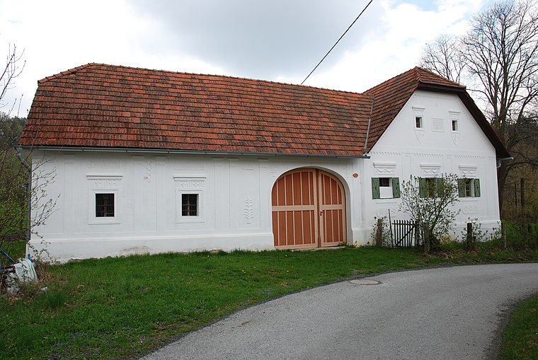
Filialkirche Wiesfleck
Church

Photo: Ueb-at, CC BY-SA 3.0.
Filialkirche Wiesfleck is a church, which is situated 2 km south of Bio Imkerei Lehner.
Pinkafeld Airport
Aerodrome

Photo: Carsten Steger, CC BY-SA 4.0.
Pinkafeld Airport is a private use airport located 2 kilometres north-northwest of Pinkafeld, Burgenland, Austria. Pinkafeld Airport is situated 3 km southwest of Bio Imkerei Lehner.
Filialkirche Hochart
Church

Photo: Ueb-at, CC BY-SA 3.0.
Filialkirche Hochart is a church, which is situated 2½ km west of Bio Imkerei Lehner.
Places in the Area
Nearby places include Schreibersdorf and Weinberg im Burgenland.

Bio Imkerei Lehner
- Type: Shop
- Address: Einschichtstraße 22, Schreibersdorf, 7425
- Location: Wiesfleck, Oberwart District, Burgenland, Austria, Central Europe, Europe
- View on OpenStreetMap
Latitude
47.40407° or 47° 24′ 15″ northLongitude
16.14573° or 16° 8′ 45″ eastOperator
LehnerOpen location code
8FVRC43W+J7OpenStreetMap ID
node 11938921515OpenStreetMap feature
shop=honey
This page is based on OpenStreetMap, Wikidata, and Wikimedia Commons.
We’d love your help improving our open data sources. Thank you for contributing.
Satellite Map
Discover Bio Imkerei Lehner from above in high-definition satellite imagery.
Notable Places Nearby
Highlights include Wasserbunker Schreibersdorf Einschicht and Labyrinth.
Nearby Places
Explore places such as CaMiNi Kinderladen and Tischlerei Lehner.
Burgenland: Must-Visit Destinations
Delve into Eisenstadt, Neusiedl am See, Rust, and Güssing.
Curious Shops to Discover
Uncover intriguing shops from every corner of the globe.
About Mapcarta. Data © OpenStreetMap contributors and available under the Open Database License". Text is available under the CC BY-SA 4.0 license, except for photos, directions, and the map. Photo: Wikimedia, CC BY-SA 4.0.