Suc de Fiallet
Suc de Fiallet is a peak in Saint-Julien-du-Pinet, Arrondissement of Yssingeaux, Auvergne-Rhône-Alpes. Suc de Fiallet is situated nearby to the hamlet Les Rullières, as well as near Montméat.| Tap on a place to explore it |
Places of Interest
Highlights include Castle of Vaux and Église Saint-Marcel de Mézères.

Église Saint-Marcel de Mézères
Church
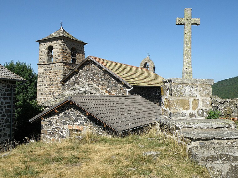
Photo: Wikimedia, Public domain.
Église Saint-Marcel de Mézères is a church.
Chapelle Notre-Dame de Glavenas
Church

Photo: PEJKERT Michel, CC BY-SA 3.0.
Chapelle Notre-Dame de Glavenas is a church.
Places in the Area
Nearby places include Rosières and Mézères.
Rosières
Village

Photo: Skipper69, CC BY-SA 3.0.
Rosières is a commune in the Haute-Loire department in south-central France.
Mézères
Village
Photo: Wikimedia, Public domain.
Mézères is a commune in the Haute-Loire department in south-central France.
Bessamorel
Village

Photo: Ludo29, CC BY-SA 3.0.
Bessamorel is a commune in the Haute-Loire department in south-central France.
Suc de Fiallet
- Type: Peak
- Category: landform
- Location: Saint-Julien-du-Pinet, Arrondissement of Yssingeaux, Haute-Loire, Auvergne-Rhône-Alpes, France, Europe
- View on OpenStreetMap
Latitude
45.1499° or 45° 8′ 60″ northLongitude
4.0289° or 4° 1′ 44″ eastOpen location code
8FQ642XH+XHOpenStreetMap ID
node 11991839420OpenStreetMap feature
natural=peak
This page is based on OpenStreetMap, Wikidata, and Wikimedia Commons.
We’d love your help improving our open data sources. Thank you for contributing.
Satellite Map
Discover Suc de Fiallet from above in high-definition satellite imagery.
Localities in the Area
Explore places such as Les Rullières and Montméat.
Notable Places Nearby
Highlights include Suc des Rullières and Cimetière de Saint-Julien du Pinet.
Auvergne-Rhône-Alpes: Must-Visit Destinations
Delve into Lyon, Grenoble, Clermont-Ferrand, and Saint-Étienne.
Curious Peaks to Discover
Uncover intriguing peaks from every corner of the globe.
About Mapcarta. Data © OpenStreetMap contributors and available under the Open Database License". Text is available under the CC BY-SA 4.0 license, except for photos, directions, and the map. Photo: Pedelecs, CC BY-SA 3.0.