Igreja Campo
Igreja Campo is a bus stop in Campo e Sobrado, Valongo Municipality, Porto District. Igreja Campo is situated nearby to the community center Centro Paroquial de Campo, as well as near the church Igreja de São Martinho do Campo.| Tap on a place to explore it |
Places of Interest Nearby
Highlights include Biblioteca Municipal de Valongo and Valongo train station.
Biblioteca Municipal de Valongo
Library

Photo: Vitor Oliveira, CC BY-SA 2.0.
Biblioteca Municipal de Valongo is a library, which is situated 2½ km northwest of Igreja Campo.
Valongo train station
Railway stop
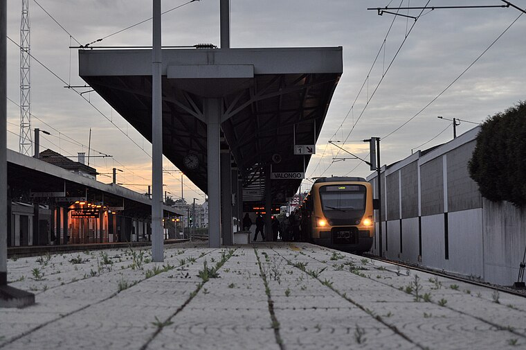
Photo: Giugiaro, CC BY-SA 3.0.
Valongo train station is a railway stop, which is situated 2 km west of Igreja Campo.
Cruzeiro de Valongo
Cross

Photo: Vitor Oliveira, CC BY-SA 2.0.
Cruzeiro de Valongo is a cross, which is situated 2½ km west of Igreja Campo.
Places in the Area
Nearby places include Couce and Astromil.
Couce
Hamlet

Photo: R.f.s.oliveira, CC BY-SA 3.0.
Couce is a hamlet, which is situated 3½ km southwest of Igreja Campo.
Astromil
Village
Astromil is a Portuguese parish of the municipality of Paredes. The population in 2011 was 1,086, in an area of 1.93 km2. Astromil is situated 4 km northeast of Igreja Campo.
São Pedro da Cova
Town

Photo: Vitor Oliveira, CC BY-SA 2.0.
São Pedro da Cova is a town, which is situated 5 km southwest of Igreja Campo.
Igreja Campo
- Type: Bus stop
- Category: transportation
- Location: Campo e Sobrado, Valongo Municipality, Porto District, Portugal, Iberia, Europe
- View on OpenStreetMap
Latitude
41.18397° or 41° 11′ 2″ northLongitude
-8.464° or 8° 27′ 50″ westOperator
UNIRNetwork
UNIROpen location code
8CHH5GMP+HCOpenStreetMap ID
node 12001132759OpenStreetMap feature
highway=bus_stopOpenStreetMap feature
public_transport=platform
This page is based on OpenStreetMap, Wikidata, and Wikimedia Commons.
We’d love your help improving our open data sources. Thank you for contributing.
Satellite Map
Discover Igreja Campo from above in high-definition satellite imagery.
Notable Places Nearby
Highlights include Centro Paroquial de Campo and Igreja de São Martinho do Campo.
Nearby Places
Explore places such as Igreja Campo and Viveiros Sol Poente 3.
Portugal: Must-Visit Destinations
Delve into Lisbon, Caldas da Rainha, Porto, and Coimbra.
Curious Bus Stops to Discover
Uncover intriguing bus stops from every corner of the globe.
About Mapcarta. Data © OpenStreetMap contributors and available under the Open Database License". Text is available under the CC BY-SA 4.0 license, except for photos, directions, and the map. Photo: Tsy1980, CC BY-SA 4.0.