Lotseneck
Lotseneck is a kiosk in Cuxhaven, Elbe-Weser Triangle, Lower Saxony which is located on Schillerstraße. Lotseneck is situated nearby to the quarter Lotsenviertel, as well as near the square Magda-Roos-Platz.| Tap on a place to explore it |
- Opening hours: Monday—Saturday 7:00 AM—1:00 PM
- Email: info@lotseneck.de
- Type: Kiosk
- Address: Schillerstraße 38, Cuxhaven, 27472
- Wheelchair access: yes
Places of Interest Nearby
Highlights include Rathaus Cuxhaven and Leuchtfeuer Cuxhaven.
Rathaus Cuxhaven
Town hall

Photo: Raboe001, CC BY-SA 3.0 de.
Rathaus Cuxhaven is a town hall, which is situated 240 metres southwest of Lotseneck.
Leuchtfeuer Cuxhaven
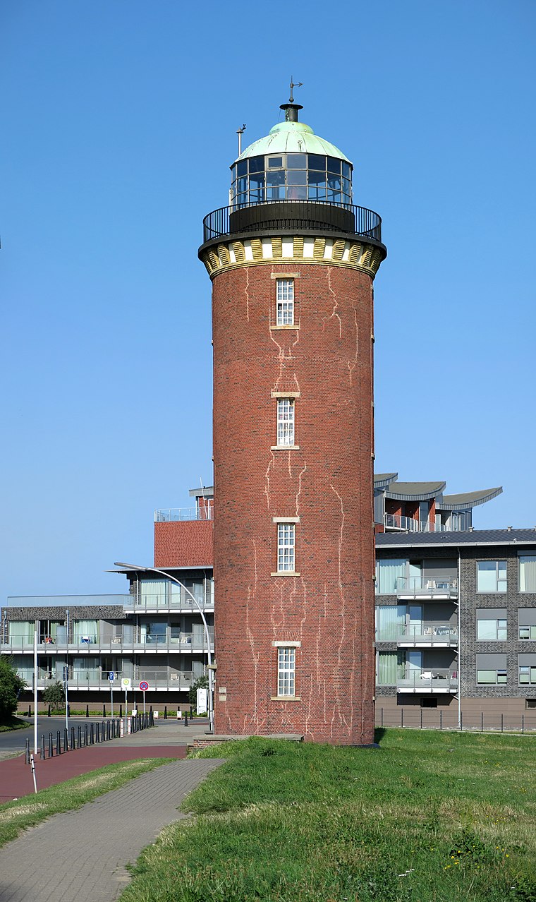
Photo: Milseburg, CC BY-SA 4.0.
Leuchtfeuer Cuxhaven is situated 540 metres northeast of Lotseneck.

Places in the Area
Nearby places include Lotsenviertel and Döse.

Döse
Suburb

Photo: Tuxyso, CC BY-SA 3.0.
Döse the northernmost town in Lower Saxony, Germany at the point where the River Elbe flows into the North Sea. It is a borough of the city Cuxhaven and a popular seaside resort.

Lotseneck
- Category: shop
- Location: Cuxhaven, Cuxhaven, Elbe-Weser Triangle, Lower Saxony, Germany, Central Europe, Europe
- View on OpenStreetMap
Latitude
53.87002° or 53° 52′ 12″ northLongitude
8.70084° or 8° 42′ 3″ eastOperator
M. WeberOpen location code
9F5CVPC2+28OpenStreetMap ID
node 12039002652OpenStreetMap feature
shop=kioskOpenStreetMap attribute
wheelchair=yes
This page is based on OpenStreetMap, Wikidata, and Wikimedia Commons.
We’d love your help improving our open data sources. Thank you for contributing.
Satellite Map
Discover Lotseneck from above in high-definition satellite imagery.
Notable Places Nearby
Highlights include Magda-Roos-Platz and Referat Sicherheit, Ordnung und Katastrophenschutz.
Nearby Places
Explore places such as G. Kratzmann and Eiscafé Venezia.
Elbe-Weser Triangle: Must-Visit Destinations
Delve into Bremerhaven, Stade, Buxtehude, and Neuwerk.
Curious Kiosks to Discover
Uncover intriguing kiosks from every corner of the globe.
About Mapcarta. Data © OpenStreetMap contributors and available under the Open Database License". Text is available under the CC BY-SA 4.0 license, except for photos, directions, and the map. Photo: Ralf Roletschek, CC BY-SA 3.0.