Angusta Café
Angusta Café is a café in Sankt Gilgen, Salzburg-Umgebung District, Salzburg. Angusta Café is situated nearby to the museum Mozarthaus St. Gilgen, as well as near St. Gilgen International School.| Tap on a place to explore it |
Places of Interest Nearby
Highlights include Mozarthaus St. Gilgen and Town hall, Sankt Gilgen.
Mozarthaus St. Gilgen
Museum
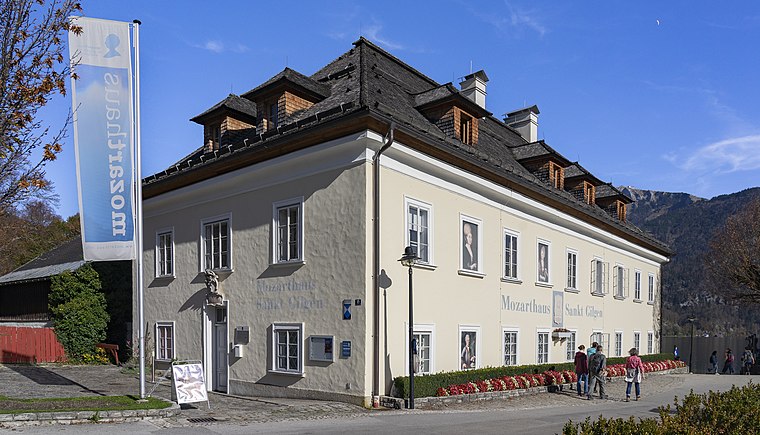
Photo: Stefan Fadinger, CC BY-SA 4.0.
Mozarthaus St. Gilgen is a museum.
Town hall, Sankt Gilgen
Town hall

Photo: Helmlechner, CC BY-SA 4.0.
Town hall, Sankt Gilgen is situated 230 metres west of Angusta Café.
Heimatkundliches Museum Sankt Gilgen
Museum

Photo: Szojak, CC BY-SA 3.0 at.
Heimatkundliches Museum Sankt Gilgen is situated 220 metres west of Angusta Café.
Places in the Area
Nearby places include Hintersee.
Hintersee
Village
Hintersee is a municipality in the district of Salzburg-Umgebung in the state of Salzburg in Austria. Hintersee is situated 8 km southwest of Angusta Café.
Angusta Café
- Opening hours: Wednesday—Sunday 10:00 AM—5:00 PM
- Type: Café
- Location: Sankt Gilgen, Salzburg-Umgebung District, Salzburg, Austria, Central Europe, Europe
- View on OpenStreetMap
Latitude
47.7665° or 47° 45′ 59″ northLongitude
13.36748° or 13° 22′ 3″ eastOpen location code
8FVMQ988+JXOpenStreetMap ID
node 12039704622OpenStreetMap feature
amenity=cafe
This page is based on OpenStreetMap, Wikidata, and Wikimedia Commons.
We’d love your help improving our open data sources. Thank you for contributing.
Satellite Map
Discover Angusta Café from above in high-definition satellite imagery.
Notable Places Nearby
Highlights include St. Gilgen International School and Freiwillige Feuerwehr St. Gilgen.
Nearby Places
Explore places such as Restaurant Rosam and Pension Rosam.
Salzburg: Must-Visit Destinations
Delve into Salzburg, Bischofshofen, Bad Gastein, and Zell am See.
Curious Cafés to Discover
Uncover intriguing cafés from every corner of the globe.
About Mapcarta. Data © OpenStreetMap contributors and available under the Open Database License". Text is available under the CC BY-SA 4.0 license, except for photos, directions, and the map. Photo: Wikimedia, CC BY-SA 2.5.