Undri Tschugge
Undri Tschugge is a locality in Randa, Visp District, Valais. Undri Tschugge is situated nearby to the village Randa, as well as near the locality Eggini.| Tap on a place to explore it |
Places of Interest
Highlights include Suspension bridge Charles Kuonen and Randa railway station.
Suspension bridge Charles Kuonen

Photo: Theo lauber, CC BY-SA 4.0.
At the time of its opening in July 2017, the Charles Kuonen Suspension Bridge was the longest pedestrian suspension bridge in the world. It is located in Randa, Switzerland and replaced the defunct Europabrücke, which had been damaged by a rock slide.
Randa railway station
Railway station

Photo: Gürbetaler, CC BY-SA 4.0.
Randa railway station is a railway station in the municipality of Randa, in the Swiss canton of Valais. It is an intermediate stop on the 1,000 mm metre gauge Brig–Zermatt line and is served by local trains only.

Places in the Area
Nearby places include Randa and Täsch.
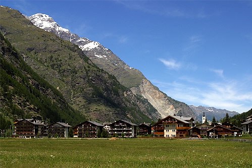
Randa
Village

Photo: Wikimedia, CC BY-SA 3.0.
Randa is a municipality in the district of Visp in the canton of Valais in Switzerland. It is located between the Weisshorn and the Dom in the Matter Valley.
Täsch
Village
 Täsch is a municipality in the district of Visp in the canton of Valais in Switzerland. It is located about 5 km north of Zermatt. The local language is Swiss German. Täsch is situated 3½ km south of Undri Tschugge.
St. Niklaus
Village

Photo: Roylindman, CC BY-SA 3.0.
St. Niklaus is a village and a municipality in the Mattertal, part of the district of Visp in the canton of Valais in Switzerland. St. Niklaus is situated 9 km north of Undri Tschugge.
Undri Tschugge
- Type: Locality
- Location: Randa, Visp District, Valais, Switzerland, Central Europe, Europe
- View on OpenStreetMap
Latitude
46.09746° or 46° 5′ 51″ northLongitude
7.78915° or 7° 47′ 21″ eastOpen location code
8FR93QWQ+XMOpenStreetMap ID
node 12040357855OpenStreetMap feature
place=locality
This page is based on OpenStreetMap, Wikidata, and Wikimedia Commons.
We’d love your help improving our open data sources. Thank you for contributing.
Satellite Map
Discover Undri Tschugge from above in high-definition satellite imagery.
Localities in the Area
Explore places such as Eggini and Gere.
Notable Places Nearby
Highlights include Kapelle Wildi and Stellplatz Wildi.
Valais: Must-Visit Destinations
Delve into Sion, Zermatt, Martigny, and Brig.
Curious Localities to Discover
Uncover intriguing localities from every corner of the globe.
About Mapcarta. Data © OpenStreetMap contributors and available under the Open Database License". Text is available under the CC BY-SA 4.0 license, except for photos, directions, and the map. Photo: Debugman, CC BY 3.0.