Silkes Plan B
Silkes Plan B is a shop in Sangerhausen, Mansfeld-Südharz, Saxony-Anhalt which is located on Riestedter Straße. Silkes Plan B is situated nearby to the church St. Ulrici (Sangerhausen), as well as near the castle Musikschule „Altes Schloss“.| Tap on a place to explore it |
Places of Interest Nearby
Highlights include St. Ulrici (Sangerhausen) and Amtsgericht Sangerhausen, neues Schloss.
St. Ulrici (Sangerhausen)
Church

Photo: Wikimedia, CC BY-SA 3.0.
St. Ulrici (Sangerhausen) is a church, which is situated 120 metres west of Silkes Plan B.
Amtsgericht Sangerhausen, neues Schloss
Courthouse

Photo: Giorno2, CC BY-SA 4.0.
Amtsgericht Sangerhausen, neues Schloss is a courthouse, which is situated 310 metres southwest of Silkes Plan B.
Rathaus Sangerhausen
Town hall
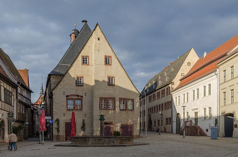
Photo: Tilman2007, CC BY-SA 3.0.
Rathaus Sangerhausen is a town hall, which is situated 320 metres southwest of Silkes Plan B.
Places in the Area
Nearby places include Sangerhausen and Lengefeld.
Sangerhausen
Town

Photo: Наталия19, CC BY-SA 3.0.
Sangerhausen is a town in Saxony-Anhalt, central Germany, capital of the district of Mansfeld-Südharz. It is situated southeast of the Harz, approx. 35 kilometres east of Nordhausen, and 50 km west of Halle. About 26,000 people live in Sangerhausen.
Lengefeld
Village

Photo: B.Thomas95, CC BY-SA 4.0.
Lengefeld is a village, which is situated 4 km northwest of Silkes Plan B.
Gonna
Village

Photo: Jwaller, CC BY-SA 4.0.
Gonna is a village, which is situated 4 km north of Silkes Plan B.
Silkes Plan B
- Type: Shop
- Address: Riestedter Straße 5, Sangerhausen, 06526
- Location: Sangerhausen, Mansfeld-Südharz, Saxony-Anhalt, Germany, Central Europe, Europe
- View on OpenStreetMap
Latitude
51.4744° or 51° 28′ 28″ northLongitude
11.30321° or 11° 18′ 12″ eastOperator
Silke BahrOpen location code
9F3HF8F3+Q7OpenStreetMap ID
node 12043845863OpenStreetMap feature
shop=food
This page is based on OpenStreetMap, Wikidata, and Wikimedia Commons.
We’d love your help improving our open data sources. Thank you for contributing.
Satellite Map
Discover Silkes Plan B from above in high-definition satellite imagery.
Notable Places Nearby
Highlights include Musikschule „Altes Schloss“ and Altes Schloss Sangerhausen.
Nearby Places
Explore places such as Der Allerletzte Laden and Villa Sonne.
Saxony-Anhalt: Must-Visit Destinations
Delve into Magdeburg, Halle, Wittenberg, and Quedlinburg.
Curious Shops to Discover
Uncover intriguing shops from every corner of the globe.
About Mapcarta. Data © OpenStreetMap contributors and available under the Open Database License". Text is available under the CC BY-SA 4.0 license, except for photos, directions, and the map. Photo: GMM, Public domain.