Doris Hütter
Doris Hütter is a memorial in Berlin, Berlin. Doris Hütter is situated nearby to the health club Club Athleten, as well as near the cemetery Alter Garnisonfriedhof Berlin.| Tap on a place to explore it |
Places of Interest Nearby
Highlights include Fernsehturm Berlin and Pergamon Museum.
Fernsehturm Berlin
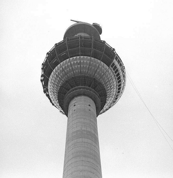
Photo: Wikimedia, CC BY-SA 3.0 de.
The Fernsehturm in central Berlin was constructed between 1965 and 1969 by the government of the German Democratic Republic as both a functional broadcasting facility and a symbol of Communist power. Fernsehturm Berlin is situated 1 km south of Doris Hütter.
Pergamon Museum
Museum
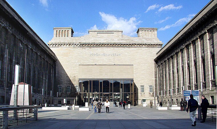
Photo: Wikimedia, CC BY-SA 4.0.
The Pergamon Museum is a listed building on the Museum Island in the historic centre of Berlin, Germany. It was built from 1910 to 1930 by order of Emperor Wilhelm II and according to plans by Alfred Messel and Ludwig Hoffmann in Stripped Classicism style. Pergamon Museum is situated 1 km southwest of Doris Hütter.
Alter Garnisonfriedhof Berlin
Cemetery

Photo: 1971markus, CC BY-SA 4.0.
Alter Garnisonfriedhof Berlin is a cemetery.
Places in the Area
Nearby places include Scheunenviertel and Spandauer Vorstadt.
Scheunenviertel
Neighborhood
Scheunenviertel is a neighborhood of Mitte in the centre of Berlin. It is situated to the north of the medieval Altberlin area, east of the Rosenthaler Straße and Hackescher Markt.
Spandauer Vorstadt
Quarter
Spandauer Vorstadt is a historic district in what is now the Mitte district of Berlin.
Alt-Berlin
Locality

Photo: Sludge G, CC BY-SA 2.0.
Alt-Berlin, also spelled Altberlin, is a neighborhood, situated in the Berliner locality of Mitte, part of the homonymous borough. In the 13th century it was the sister town of the old Cölln, located on the northern Spree Island in the Margraviate of Brandenburg.
Doris Hütter
- Type: Memorial
- Category: historic site
- Location: Berlin, Berlin, Stadt, Berlin, Germany, Central Europe, Europe
- View on OpenStreetMap
Latitude
52.52889° or 52° 31′ 44″ northLongitude
13.40446° or 13° 24′ 16″ eastOpen location code
9F4MGCH3+HQOpenStreetMap ID
node 12056238034OpenStreetMap feature
historic=memorial
This page is based on OpenStreetMap, Wikidata, and Wikimedia Commons.
We’d love your help improving our open data sources. Thank you for contributing.
Satellite Map
Discover Doris Hütter from above in high-definition satellite imagery.
Notable Places Nearby
Highlights include Club Athleten and Schmittz.
Nearby Places
Explore places such as Herbert Hütter and Eisig Izek Hütter.
Berlin: Must-Visit Destinations
Delve into Mitte, East Central, City West, and East Berlin.
Curious Memorials to Discover
Uncover intriguing memorials from every corner of the globe.
About Mapcarta. Data © OpenStreetMap contributors and available under the Open Database License". Text is available under the CC BY-SA 4.0 license, except for photos, directions, and the map. Photo: Berthold Werner, CC BY-SA 3.0.