Fitness Hell
Fitness Hell is a health club in Breitenbach, Thierstein District, Canton of Solothurn. Fitness Hell is situated nearby to the shopping center Einkaufswagen, as well as near the church katholische Kirche.| Tap on a place to explore it |
Places of Interest Nearby
Highlights include Neu-Thierstein Castle and Laufen railway station.
Neu-Thierstein Castle
Castle
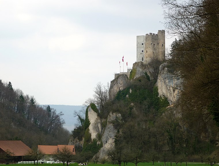
Photo: Gestumblindi, CC0.
Neu-Thierstein Castle is a ruined castle in the Swiss municipality of Büsserach in the canton of Solothurn, Switzerland. Neu-Thierstein Castle is situated 2½ km south of Fitness Hell.
Laufen railway station
Railway station

Photo: Katrin Gilger, CC BY-SA 2.0.
Laufen railway station is a railway station in the municipality of Laufen, in the Swiss canton of Basel-Landschaft. It is an intermediate stop on the Basel–Biel/Bienne line and is served by local and long-distance trains. Laufen railway station is situated 3½ km northwest of Fitness Hell.
Zwingen railway station
Railway station
 Zwingen railway station is a railway station in the municipality of Zwingen, in the Swiss canton of Basel-Landschaft. It is an intermediate stop on the Basel–Biel/Bienne line and is served by local trains only. Zwingen railway station is situated 3 km north of Fitness Hell.
Places in the Area
Nearby places include Brislach and Büsserach.
Brislach
Village

Photo: Wikimedia, CC BY-SA 3.0.
Brislach is a municipality in the district of Laufen in the canton of Basel-Country in Switzerland.
Büsserach
Village

Photo: DidiWeidmann, CC BY-SA 3.0.
Büsserach is a municipality in the district of Thierstein in the canton of Solothurn in Switzerland.
Wahlen
Village

Photo: Wikimedia, CC BY-SA 3.0.
Wahlen is a municipality in the district of Laufen in the canton of Basel-Country in Switzerland.
Fitness Hell
- Type: Health club
- Categories: recreation area and sports location
- Location: Breitenbach, Thierstein District, Canton of Solothurn, Switzerland, Central Europe, Europe
- View on OpenStreetMap
Latitude
47.40696° or 47° 24′ 25″ northLongitude
7.54362° or 7° 32′ 37″ eastOpen location code
8FV9CG4V+QCOpenStreetMap ID
node 12063694910OpenStreetMap feature
leisure=fitness_centre
This page is based on OpenStreetMap, Wikidata, and Wikimedia Commons.
We’d love your help improving our open data sources. Thank you for contributing.
Satellite Map
Discover Fitness Hell from above in high-definition satellite imagery.
Notable Places Nearby
Highlights include Einkaufswagen and katholische Kirche.
Nearby Places
Explore places such as Physio Hell and Cafe Pöstli.
Switzerland: Must-Visit Destinations
Delve into Zurich, Berne, Geneva, and Basel.
Curious Health Clubs to Discover
Uncover intriguing health clubs from every corner of the globe.
About Mapcarta. Data © OpenStreetMap contributors and available under the Open Database License". Text is available under the CC BY-SA 4.0 license, except for photos, directions, and the map. Photo: Simonizer, CC BY-SA 2.0 de.