Jochen Pusch
Jochen Pusch is a music school in Aachen, Cologne District, North Rhine-Westphalia. Jochen Pusch is situated nearby to the government office Fachbereich Klima und Umwelt FB 36, as well as near Kaiser-Friedrich-Park.| Tap on a place to explore it |
Places of Interest Nearby
Highlights include Kaiser-Friedrich-Park and Gut Bodenhof.
Kaiser-Friedrich-Park
Park

Photo: A.Savin, CC BY-SA 3.0.
Kaiser-Friedrich-Park is situated 430 metres northwest of Jochen Pusch.
Gut Bodenhof
Ruins

Photo: Caspar Wolf, Public domain.
Gut Bodenhof is a ruins, which is situated 480 metres northeast of Jochen Pusch.
Aachen Hauptbahnhof
Railway station
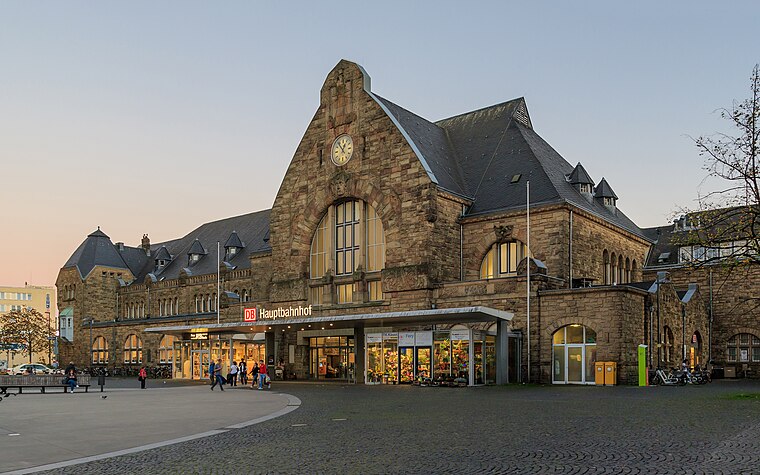 Aachen Hauptbahnhof is the most important railway station for the city of Aachen, in the far west of Germany near the Dutch and Belgian border. It is the largest of the four currently active Aachen stations, and is integrated into the long-distance network. Aachen Hauptbahnhof is situated 1½ km northeast of Jochen Pusch.
Places in the Area
Nearby places include Burtscheid and Kaiserplatz.
Burtscheid
Suburb

Photo: ArthurMcGill, CC BY-SA 4.0.
Burtscheid is a district of the city of Aachen, part of the Aachen-Mitte Stadtbezirk. It is a health resort.

Preuswald
Suburb

Photo: ArthurMcGill, CC BY-SA 4.0.
Preuswald is a suburb, which is situated 3 km southwest of Jochen Pusch.
Jochen Pusch
- Type: Music school
- Category: education
- Location: Aachen, Aachen, Cologne District, Eifel, North Rhine-Westphalia, Germany, Central Europe, Europe
- View on OpenStreetMap
Latitude
50.75643° or 50° 45′ 23″ northLongitude
6.07777° or 6° 4′ 40″ eastOpen location code
9F28Q34H+H4OpenStreetMap ID
node 12069465090OpenStreetMap feature
amenity=music_school
This page is based on OpenStreetMap, Wikidata, and Wikimedia Commons.
We’d love your help improving our open data sources. Thank you for contributing.
Satellite Map
Discover Jochen Pusch from above in high-definition satellite imagery.
Notable Places Nearby
Highlights include Fachbereich Klima und Umwelt FB 36 and Parzival-Schule Aachen.
Nearby Places
Explore places such as Maria-Theresia-Allee and Familiengartenverein Ronheider-Weg 1920 e.V..
Eifel: Must-Visit Destinations
Delve into Monschau, Herzogenrath, Zülpich, and Bad Münstereifel.
Curious Music Schools to Discover
Uncover intriguing music schools from every corner of the globe.
About Mapcarta. Data © OpenStreetMap contributors and available under the Open Database License". Text is available under the CC BY-SA 4.0 license, except for photos, directions, and the map. Photo: Knipptang, CC BY-SA 3.0.