Park Ave & Douglas Station
Park Ave & Douglas Station is a bus stop in City of Omaha, Douglas, Nebraska. Park Ave & Douglas Station is situated nearby to the military installation Unsafe parking lot, as well as near the theater building Concert Amphitheatre.| Tap on a place to explore it |
Photo: Dmartin969, Public domain.
- Type: Bus stop
- Description: bus rapid transit station in Omaha, Nebraska
- Also known as: “Park Ave & Douglas”
Places of Interest Nearby
Highlights include First Unitarian Church of Omaha and Joslyn Art Museum.
First Unitarian Church of Omaha
Place of worship

Photo: Ammodramus, CC0.
The First Unitarian Church of Omaha, Nebraska is a Unitarian Universalist Church located at 3114 Harney Street in the Midtown area. First Unitarian Church of Omaha is situated 890 feet southwest of Park Ave & Douglas Station.
Joslyn Art Museum
Museum
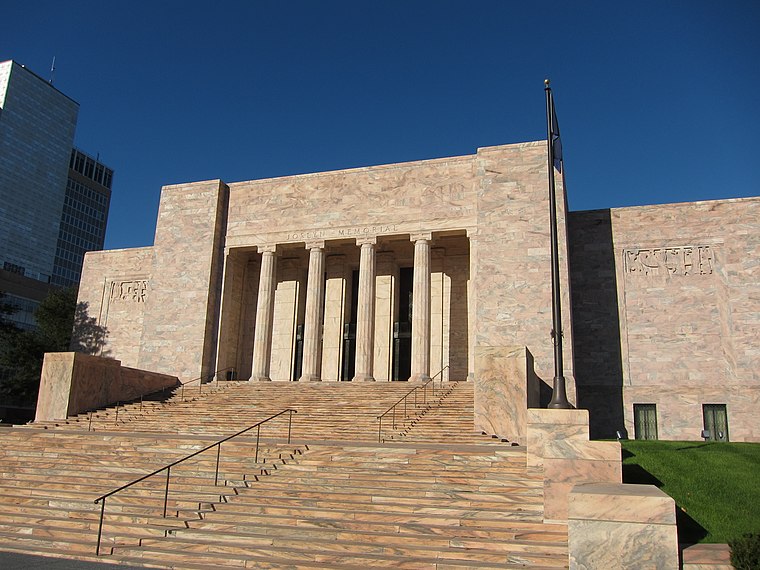 The Joslyn Art Museum, commonly referred to as the Joslyn, is a fine arts museum in Omaha, Nebraska, the largest in the state. It opened in 1931 at the initiative of Sarah H. Joslyn Art Museum is situated 2,900 feet east of Park Ave & Douglas Station.
Kountze Memorial Lutheran Church
Church

Photo: Dmartin969, Public domain.
Kountze Memorial Lutheran Church is located at 2650 Farnam Street in Midtown Omaha, Nebraska. Organized on December 5, 1858, as Emanuel's Evangelical Lutheran Church, the church is thought to be the first Lutheran congregation organized west of the Missouri River. Kountze Memorial Lutheran Church is situated 1,300 feet east of Park Ave & Douglas Station.
Places in the Area
Nearby places include Omaha and Carter Lake.
Omaha

Photo: JonClee86, CC BY-SA 3.0.
Omaha is the largest city in the US state of Nebraska, with about 486,000 residents in 2020. Tourist attractions in Omaha include history, sports, outdoors and cultural experiences.
Carter Lake
Town
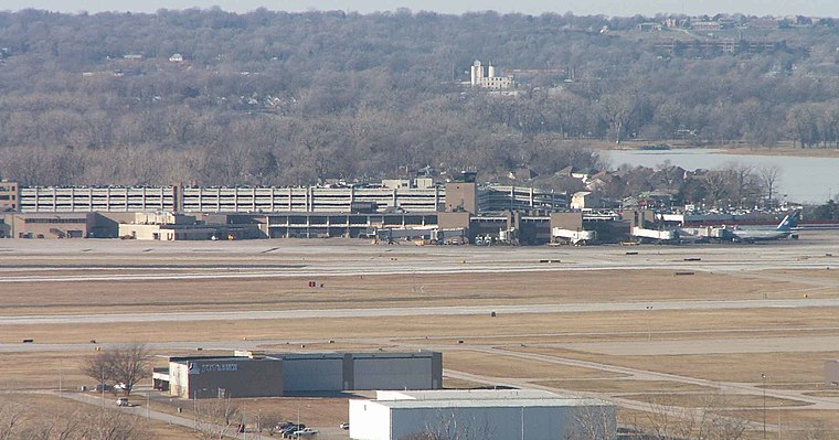
Photo: Americasroof, CC BY-SA 2.5.
Carter Lake is a city in Pottawattamie County, Iowa, United States. A suburb of Omaha, Nebraska, it sits surrounding the south and west sides of the region's major airport, Eppley Airfield. Carter Lake is situated 2½ miles northeast of Park Ave & Douglas Station.
Benson
Neighborhood

Photo: Ammodramus, CC0.
Benson is a historic neighborhood in North Omaha in Omaha, Nebraska, originally platted in 1887 and annexed to the City of Omaha in 1917. Benson is situated 3 miles northwest of Park Ave & Douglas Station.
Park Ave & Douglas Station
- Categories: station and transportation
- Location: City of Omaha, Douglas, Nebraska, Great Plains, United States, North America
- View on OpenStreetMap
Latitude
41.25866° or 41° 15′ 31″ northLongitude
-95.95618° or 95° 57′ 22″ westOperator
Metro TransitNetwork
Omaha Rapid Bus TransitOpen location code
86H6725V+FGOpenStreetMap ID
node 12073812722OpenStreetMap feature
highway=bus_stopOpenStreetMap feature
public_transport=platformWikidata ID
Q134740562
This page is based on OpenStreetMap, Wikidata, and Wikimedia Commons.
We’d love your help improving our open data sources. Thank you for contributing.
Satellite Map
Discover Park Ave & Douglas Station from above in high-definition satellite imagery.
Notable Places Nearby
Highlights include Unsafe parking lot and Concert Amphitheatre.
Nearby Places
Explore places such as Park Ave & Douglas ORBT Station and Walgreens.
Nebraska: Must-Visit Destinations
Delve into Omaha, Lincoln, Grand Island, and Kearney.
Curious Bus Stops to Discover
Uncover intriguing bus stops from every corner of the globe.
About Mapcarta. Data © OpenStreetMap contributors and available under the Open Database License". Text is available under the CC BY-SA 4.0 license, except for photos, directions, and the map. Photo: Dmartin969, Public domain.