Northern Hills
Northern Hills is a neighborhood in Lancaster, Nebraska. Northern Hills is situated nearby to the quarter Fallbrook, as well as near the neighborhood Legends.| Tap on a place to explore it |
Places in the Area
Nearby places include Arbor and Raymond.
Arbor
Hamlet
Arbor is an unincorporated community in Lancaster County, Nebraska, United States. Arbor is situated 2½ miles east of Northern Hills.
Raymond
Village

Photo: Ammodramus, CC0.
Raymond is a village in Lancaster County, Nebraska, United States. It is part of the Lincoln, Nebraska Metropolitan Statistical Area. The population was 159 at the 2020 census. Raymond is situated 5 miles northwest of Northern Hills.
Haymarket District
Suburb
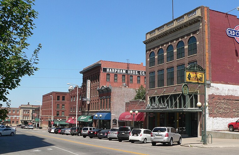
Photo: Ammodramus, CC0.
Haymarket District is a neighborhood and historic district of Downtown Lincoln, Nebraska, United States. The district was created in 1874 and was originally known as Haymarket Square. Haymarket District is situated 6 miles south of Northern Hills.
Northern Hills
- Type: Neighborhood
- Category: locality
- Location: Lancaster, Nebraska, Great Plains, United States, North America
- View on OpenStreetMap
Latitude
40.89709° or 40° 53′ 50″ northLongitude
-96.72473° or 96° 43′ 29″ westOpen location code
86G5V7WG+R4OpenStreetMap ID
node 12081684412OpenStreetMap feature
place=neighbourhood
This page is based on OpenStreetMap, Wikidata, and Wikimedia Commons.
We’d love your help improving our open data sources. Thank you for contributing.
Satellite Map
Discover Northern Hills from above in high-definition satellite imagery.
Places with the Same Name
Discover other places named “Northern Hills”.
Localities in the Area
Explore places such as Fallbrook and Legends.
Notable Places Nearby
Highlights include YMCA and Fallbrook Farmers Market.
Nebraska: Must-Visit Destinations
Delve into Lincoln, Omaha, Grand Island, and Kearney.
Curious Neighborhoods to Discover
Uncover intriguing neighborhoods from every corner of the globe.
About Mapcarta. Data © OpenStreetMap contributors and available under the Open Database License". Text is available under the CC BY-SA 4.0 license, except for photos, directions, and the map. Photo: Kahvc7, CC0.