Rio Guanajibo near Hormigueros
Rio Guanajibo near Hormigueros is a monitoring station in Guanajibo, Cabo Rojo. Rio Guanajibo near Hormigueros is situated nearby to Silva Bridge.| Tap on a place to explore it |
Places of Interest Nearby
Highlights include Silva Bridge and Mayagüez Mall.
Silva Bridge
Bridge

Photo: Wikimedia, Public domain.
The Silva Bridge is a Pratt pony truss bridge in Puerto Rico which was built in 1897. It was listed on the National Register of Historic Places in 1995 and on the Puerto Rico Register of Historic Sites and Zones in 2000. Silva Bridge is situated 320 metres southeast of Rio Guanajibo near Hormigueros.
Mayagüez Mall
Commercial area
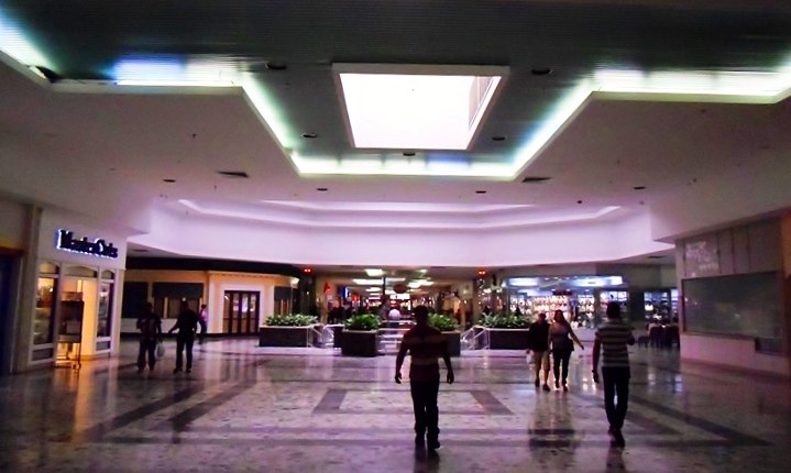
Photo: Madrican, CC BY-SA 3.0.
Mayagüez Mall is a shopping mall located in the municipalities of Mayagüez and Hormigueros. It is the third largest shopping center in Puerto Rico with a total of 1,050,000 square feet of retail space, and it is the main shopping center in western Puerto Rico. Mayagüez Mall is situated 2 km north of Rio Guanajibo near Hormigueros.
Torréns Bridge
Bridge
The Torréns Bridge is a historic bridge over the Rosario River in Hormigueros municipality, Puerto Rico. It was built in 1878 in a beam bridge structure with lattice girders and transverse joists, a design unique in the later territory of the United States. Torréns Bridge is situated 3 km southeast of Rio Guanajibo near Hormigueros.
Places in the Area
Nearby places include Hormigueros and Mayagüez.
Hormigueros

Photo: Jcarrillovii, Public domain.
Hormigueros is a town and one of the smallest municipalities of Puerto Rico, located on the island's southwestern coast in the Porta del Sol tourism region.
Mayagüez

Photo: NASA, Public domain.
Mayagüez is the largest city on the Western side of the island of Puerto Rico, in the Porta del Sol region. It has roughly 90,000 inhabitants, plus a floating population of about 15,000, on weekdays, particularly when the University of Puerto Rico at Mayagüez is not in recess.
Rio Guanajibo near Hormigueros
- Type: Monitoring station
- Also known as: “RIO GUANAJIBO NR HORMIGUEROS, PR”
- Location: Guanajibo, Cabo Rojo, Porta del Sol, Puerto Rico, Caribbean, North America
- View on OpenStreetMap
Latitude
18.14069° or 18° 8′ 27″ northLongitude
-67.14837° or 67° 8′ 54″ westElevation
4 metres (13 feet)Inception
1958Operator
United States Geological SurveyOpen location code
77CJ4VR2+7MOpenStreetMap ID
node 12090994612OpenStreetMap feature
man_made=monitoring_station
This page is based on OpenStreetMap, Wikidata, and Wikimedia Commons.
We’d love your help improving our open data sources. Thank you for contributing.
Satellite Map
Discover Rio Guanajibo near Hormigueros from above in high-definition satellite imagery.
Notable Places Nearby
Highlights include Iglesia Adventista del 7º Día - Valle Hermoso Abajo and Cuartel de la Policía Estatal de Hormigueros.
Nearby Places
Explore places such as Hogar San José and C. C.
Porta del Sol: Must-Visit Destinations
Delve into Mayagüez, Aguadilla, Rincón, and Aguada.
Curious Monitoring Stations to Discover
Uncover intriguing monitoring stations from every corner of the globe.
About Mapcarta. Data © OpenStreetMap contributors and available under the Open Database License". Text is available under the CC BY-SA 4.0 license, except for photos, directions, and the map. Photo: Wikimedia, CC0.