Altstadt Falafel
Altstadt Falafel is a fast food restaurant in Bonn, Cologne District, North Rhine-Westphalia which is located on Am Frankenbad. Altstadt Falafel is situated nearby to the work of art Familienraum, as well as near the playground Frankenbadplatz.| Tap on a place to explore it |
- Type: Fast food restaurant
- Address: Am Frankenbad
- Wheelchair access: yes
Places of Interest Nearby
Highlights include Familienraum and August-Macke-Haus.

August-Macke-Haus
Museum
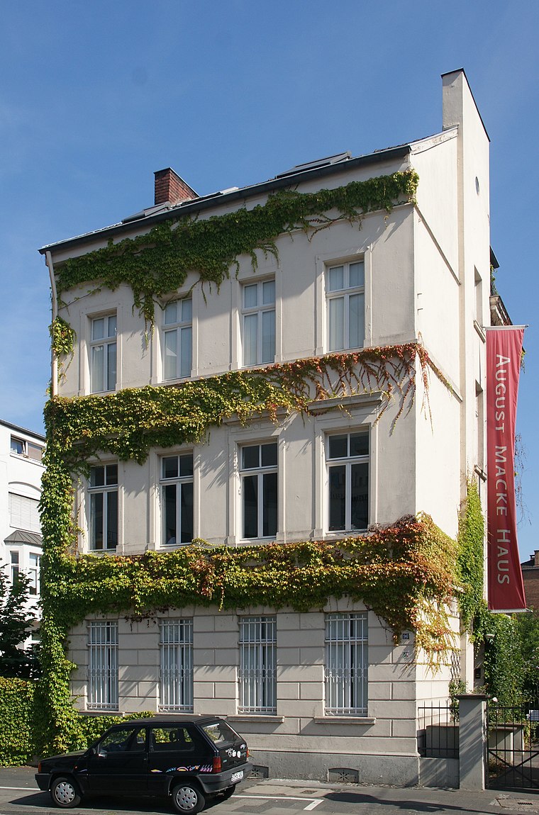
Photo: Tohma, CC BY-SA 4.0.
The August-Macke-Haus or August Macke House is a museum in Bonn, Germany, opened in 1991, dedicated to the expressionist painter August Macke. It is located in Macke's former home, where he lived from 1911 to 1914. August-Macke-Haus is situated 260 metres southwest of Altstadt Falafel.
Bonn Women’s Museum
Museum

Photo: Leonce49, CC BY-SA 3.0 de.
The Bonn Women's Museum is a women's museum in Bonn, Germany. It was founded in 1981 by Marianne Pitzen and an interdisciplinary group of working women, and claims to be the first museum of its kind in the world. Bonn Women’s Museum is situated 310 metres northeast of Altstadt Falafel.
Places in the Area
Nearby places include Endenich and Poppelsdorf.
Endenich
Quarter

Photo: Mrhubble, CC BY-SA 3.0.
Endenich is a neighborhood in the western part of Bonn, Germany. Before 1904 it was an independent municipality. The village of Endenich was founded in the 8th century, and was first mentioned in 804 as Antiniche. Today, about 12,000 people live in Endenich.
Poppelsdorf
Quarter
Bonn is a federal city in the German state of North Rhine-Westphalia, located on the banks of the Rhine. With a population exceeding 300,000, it lies about 24 km south-southeast of Cologne, in the southernmost part of the Rhine-Ruhr region.
Beuel
Suburb

Photo: AKirch-Bonn, CC BY-SA 4.0.
Beuel is a city borough of Bonn, Germany. It has a population of 67,827. Beuel is situated 2½ km east of Altstadt Falafel.
Altstadt Falafel
- Categories: food and restaurant
- Location: Bonn, Cologne District, Cologne Lowland, North Rhine-Westphalia, Germany, Central Europe, Europe
- View on OpenStreetMap
Latitude
50.7389° or 50° 44′ 20″ northLongitude
7.08916° or 7° 5′ 21″ eastOpen location code
9F29P3QQ+HMOpenStreetMap ID
node 12120641104OpenStreetMap feature
amenity=fast_foodOpenStreetMap attribute
wheelchair=yes
This page is based on OpenStreetMap, Wikidata, and Wikimedia Commons.
We’d love your help improving our open data sources. Thank you for contributing.
Satellite Map
Discover Altstadt Falafel from above in high-definition satellite imagery.
Notable Places Nearby
Highlights include Stolperstein dedicated to Josef Faust and Frankenbadplatz.
Nearby Places
Explore places such as Cafe-Roller am Frankenbad and Black Veg.
Cologne Lowland: Must-Visit Destinations
Delve into Cologne, Leverkusen, Siegburg, and Bad Honnef.
Curious Fast Food Restaurants to Discover
Uncover intriguing fast food restaurants from every corner of the globe.
About Mapcarta. Data © OpenStreetMap contributors and available under the Open Database License". Text is available under the CC BY-SA 4.0 license, except for photos, directions, and the map. Photo: Danapit, CC BY-SA 3.0.