Siebenrücken
Siebenrücken is a peak in Saxony, Germany and has an elevation of 96 metres. Siebenrücken is situated nearby to the village Jacobsthal, as well as near Gohlis.| Tap on a place to explore it |
Places of Interest
Highlights include Station 70 Jacobsthal and Kgl.-sächs. Postmeilenstein Strehla.
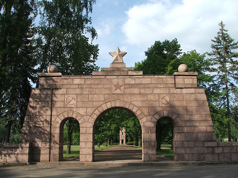
Station 70 Jacobsthal
Historic site

Photo: Radler59, CC BY-SA 3.0.
Station 70 Jacobsthal is a historic site.
Kgl.-sächs. Postmeilenstein Strehla
Historic site

Photo: Oxensepp, CC BY-SA 3.0.
Kgl.-sächs. Postmeilenstein Strehla is a historic site.
Places in the Area
Nearby places include Riesa and Zeithain.
Riesa

Photo: Radler59, CC BY-SA 4.0.
Riesa is a town in the district of Meißen in Saxony, Germany. It is located on the river Elbe, approximately 40 kilometres northwest of Dresden.
Strehla
Town

Photo: Shelog, CC BY-SA 3.0.
Strehla is a small town in the district of Meißen, Saxony, Germany. It is located on the river Elbe, north of Riesa. This place name means arrow in Sorbian. Strehla includes the following subdivisions:…
Siebenrücken
- Type: Peak with an elevation of 96 metres
- Category: landform
- Location: Saxony, Germany, Central Europe, Europe
- View on OpenStreetMap
Latitude
51.3632° or 51° 21′ 47″ northLongitude
13.2903° or 13° 17′ 25″ eastElevation
96 metres (315 feet)Open location code
9F3M977R+74OpenStreetMap ID
node 12121635711OpenStreetMap feature
natural=peak
This page is based on OpenStreetMap, Wikidata, and Wikimedia Commons.
We’d love your help improving our open data sources. Thank you for contributing.
Satellite Map
Discover Siebenrücken from above in high-definition satellite imagery.
Places with the Same Name
Discover other places named “Siebenrücken”.
Localities in the Area
Explore places such as Jacobsthal and Gohlis.
Notable Places Nearby
Highlights include Jacobsthaler Holz and Kriegsgefangenenfriedhof Zschepa I.
Saxony: Must-Visit Destinations
Delve into Dresden, Leipzig, Chemnitz, and Meißen.
Curious Peaks to Discover
Uncover intriguing peaks from every corner of the globe.
About Mapcarta. Data © OpenStreetMap contributors and available under the Open Database License". Text is available under the CC BY-SA 4.0 license, except for photos, directions, and the map. Photo: Taxiarchos228, FAL.