Stella 174-176
Stella 174-176 is a farm shop in Paramaribo District, Suriname which is located on Dr. Sophie Redmondstraat. Stella 174-176 is situated nearby to Bus Station Lijn 6, as well as near the marketplace Kwakoeplein.| Tap on a place to explore it |
Places of Interest Nearby
Highlights include Mosque Keizerstraat and Grote Stadskerk.
Mosque Keizerstraat
Mosque

Photo: Brokopondo, Public domain.
The Ahmadiyya Anjuman Isha’at Islam Mosque Keizerstraat is the headquarters of the Lahore Ahmadiyya Movement in Paramaribo in Suriname, the Surinaamse Islamitische Vereniging. The mosque is located in the Keizerstraat, adjacent to the Neveh Shalom Synagogue. Mosque Keizerstraat is situated 580 metres northeast of Stella 174-176.
Grote Stadskerk
Church

Photo: Otter, CC BY-SA 4.0.
Grote Stadskerk is a church of the Moravian Church. It is located on Steenbakkerijstraat in the historic centre of Paramaribo, Suriname. The building is a monument. Grote Stadskerk is situated 300 metres east of Stella 174-176.
Neveh Shalom Synagogue
Synagogue
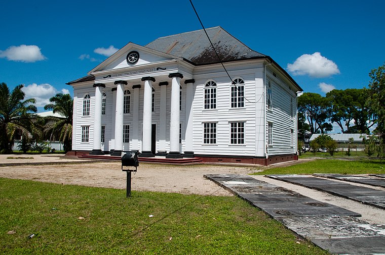
Photo: Gjbulte, CC BY-SA 3.0.
The Neveh Shalom Synagogue is a Reform Jewish congregation and synagogue, located in Paramaribo, Suriname. The congregation was established as an Orthodox community who worshipped in the Ashkenazi rite. Neveh Shalom Synagogue is situated 620 metres northeast of Stella 174-176.
Places in the Area
Nearby places include Paramaribo and Beekhuizen.
Paramaribo

Photo: Sn.fernandez, CC BY-SA 4.0.
Paramaribo, often called Par'bo, is the lively capital and only city of the sparsely inhabited country of Suriname. Home to about 240,000 people, or over half of the country's population, this laid-back South American gem lies 15 km from the Atlantic Ocean.
Beekhuizen
Village

Photo: Wikimedia, CC BY-SA 4.0.
Beekhuizen is a former sugarcane plantation and currently a resort in Suriname, located in the Paramaribo District. Its population at the 2012 census was 17,185.
Meerzorg
Village
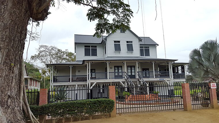
Photo: Humbert-L-Siegers, CC BY-SA 4.0.
Meerzorg is a town and resort in Suriname, located on the eastern bank of the Suriname River, directly opposite the capital Paramaribo. Its population at the 2012 census was 12,405. Meerzorg is situated 3 km southeast of Stella 174-176.
Stella 174-176
- Type: Farm shop
- Address: Dr. Sophie Redmondstraat, Paramaribo
- Categories: shop and food
- Location: Paramaribo District, Suriname, South America
- View on OpenStreetMap
Latitude
5.82497° or 5° 49′ 30″ northLongitude
-55.16353° or 55° 9′ 49″ westOpen location code
68Q6RRFP+XHOpenStreetMap ID
node 12128426166OpenStreetMap feature
shop=farm
This page is based on OpenStreetMap, Wikidata, and Wikimedia Commons.
We’d love your help improving our open data sources. Thank you for contributing.
Satellite Map
Discover Stella 174-176 from above in high-definition satellite imagery.
Notable Places Nearby
Highlights include Bus Station Lijn 6 and Kwakoeplein.
Nearby Places
Explore places such as Jolanda 171 and 172 and Vanbree 145-146.
Suriname: Must-Visit Destinations
Delve into Paramaribo, Surinamese Rainforest, East Coast, and West Coast.
Curious Farm Shops to Discover
Uncover intriguing farm shops from every corner of the globe.
About Mapcarta. Data © OpenStreetMap contributors and available under the Open Database License". Text is available under the CC BY-SA 4.0 license, except for photos, directions, and the map. Photo: S23678, CC BY-SA 3.0.