Spielplatz Harry-Rischkau-Straße
Spielplatz Harry-Rischkau-Straße is a playground in Buxtehude, Stade, Lower Saxony. Spielplatz Harry-Rischkau-Straße is situated nearby to the playground Spielplatz Im Petersmoor, as well as near the church Königreichssaal Jehovas Zeugen.| Tap on a place to explore it |
Places of Interest Nearby
Highlights include Buxtehude station and Halepaghen Grammar School.
Buxtehude station
Railway station

Photo: Gerhard kemme, CC0.
Buxtehude is a railway station in northwestern Germany. The station is located in the town of Buxtehude. It is located on two railway lines: the Lower Elbe Railway, which runs between Cuxhaven and Hamburg, and the Bremerhaven–Buxtehude line of the Eisenbahnen und Verkehrsbetriebe Elbe-Weser to Bremervörde. Buxtehude station is situated 730 metres southeast of Spielplatz Harry-Rischkau-Straße.
Halepaghen Grammar School
School

Photo: Boereck, Public domain.
The Halepaghen Grammar School, or HPS, is a gymnasium in Buxtehude. The school was mentioned for the first time in 1390 as an grammar school. The school was named after Gerhard Halepaghe, a famous graduate from Buxtehude. Halepaghen Grammar School is situated 1 km east of Spielplatz Harry-Rischkau-Straße.
St.-Petri-Kirche
Church
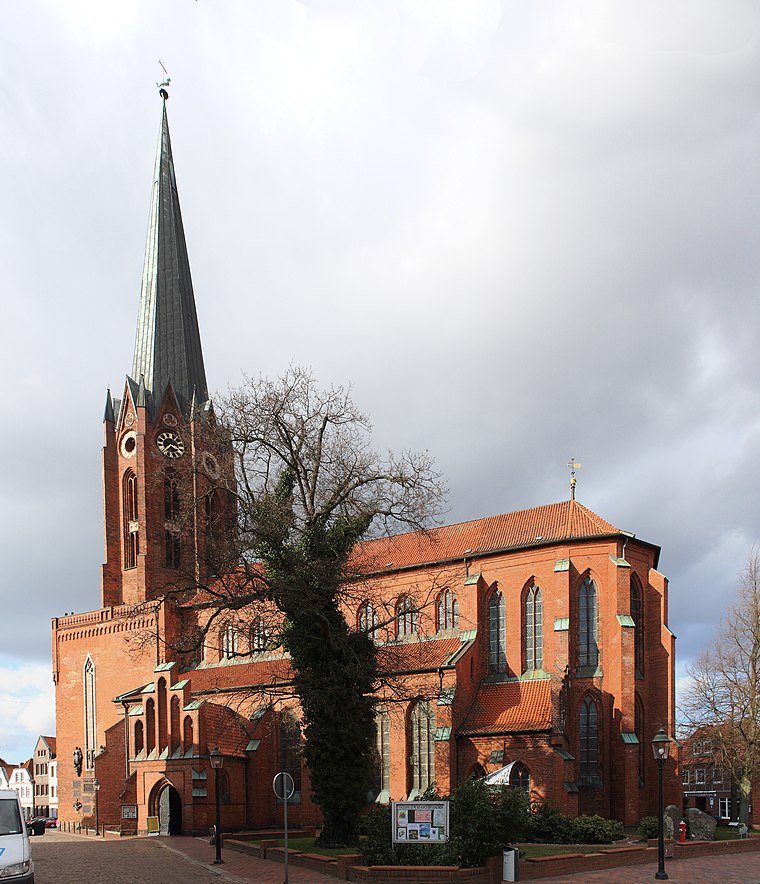
Photo: Knipptang, CC BY-SA 3.0.
St.-Petri-Kirche is a church, which is situated 1½ km east of Spielplatz Harry-Rischkau-Straße.
Places in the Area
Nearby places include Dammhausen and Neukloster.

Neukloster
Suburb

Photo: Dkvtig, CC BY-SA 4.0.
Neukloster is a suburb, which is situated 3 km west of Spielplatz Harry-Rischkau-Straße.
Ladekop
Village

Photo: Rudolph H, CC BY-SA 2.0 de.
Ladekop is a village, which is situated 5 km north of Spielplatz Harry-Rischkau-Straße.
Spielplatz Harry-Rischkau-Straße
- Type: Playground
- Category: recreation area
- Location: Buxtehude, Stade, Elbe-Weser Triangle, Lower Saxony, Germany, Central Europe, Europe
- View on OpenStreetMap
Latitude
53.47353° or 53° 28′ 25″ northLongitude
9.67861° or 9° 40′ 43″ eastOpen location code
9F5FFMFH+CCOpenStreetMap ID
node 12133023959OpenStreetMap feature
leisure=playground
This page is based on OpenStreetMap, Wikidata, and Wikimedia Commons.
We’d love your help improving our open data sources. Thank you for contributing.
Satellite Map
Discover Spielplatz Harry-Rischkau-Straße from above in high-definition satellite imagery.
Notable Places Nearby
Highlights include Spielplatz Im Petersmoor and Königreichssaal Jehovas Zeugen.
Nearby Places
Explore places such as Wohngebiet Gieselbertstraße and Buxtehude, Königsdamm.
Elbe-Weser Triangle: Must-Visit Destinations
Delve into Bremerhaven, Cuxhaven, Stade, and Neuwerk.
Curious Playgrounds to Discover
Uncover intriguing playgrounds from every corner of the globe.
About Mapcarta. Data © OpenStreetMap contributors and available under the Open Database License". Text is available under the CC BY-SA 4.0 license, except for photos, directions, and the map. Photo: hh oldman, CC BY 3.0.