Fisher Street Trailhead
Fisher Street Trailhead is a trailhead in Martinsville, Virginia. Fisher Street Trailhead is situated nearby to the church Greater Love Ministry, as well as near Doyle Street Trailhead.| Tap on a place to explore it |
Places of Interest Nearby
Highlights include Virginia Museum of Natural History and English Field.
Virginia Museum of Natural History
Museum

Photo: James St. John, CC BY 2.0.
The Virginia Museum of Natural History is the state's natural history museum located in Martinsville, Virginia founded in 1984. The museum has several different award-winning publications, is affiliated with the Smithsonian Institution, and has more than 22 million items. Virginia Museum of Natural History is situated 3,600 feet west of Fisher Street Trailhead.
English Field
Pitch
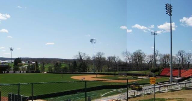
Photo: Jwalte04, Public domain.
English Field at Atlantic Union Bank Park is a baseball stadium in Blacksburg, Virginia. It is the home field of the Virginia Tech Hokies college baseball team. English Field is situated 3,000 feet north of Fisher Street Trailhead.
Martinsville High School
School
Martinsville High School is a four-year public secondary high school located in Martinsville, Virginia, United States. It is the only high school in the Martinsville City Public School system. Martinsville High School is situated 1 mile west of Fisher Street Trailhead.
Places in the Area
Nearby places include Martinsville and Villa Heights.
Martinsville
Town
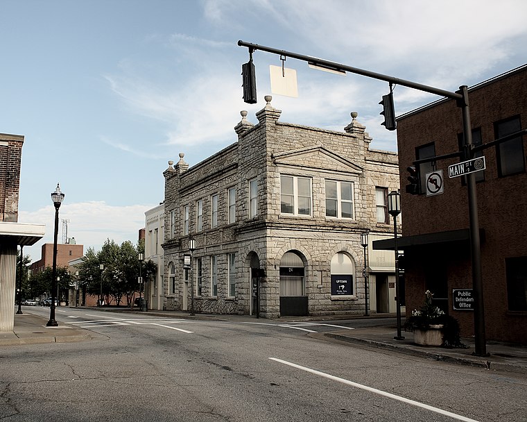
Photo: Sleddog116, CC BY-SA 3.0.
Martinsville is an independent city in the Commonwealth of Virginia in the United States. As of the 2020 census, the population was 13,485. A community of both Southside and Southwest Virginia, it is the county seat of Henry County, although the two are separate jurisdictions.
Villa Heights
Village
Villa Heights is a census-designated place in Henry County, Virginia, United States. The population was 717 at the 2010 census. It is part of the Martinsville Micropolitan Statistical Area. Villa Heights is situated 2½ miles west of Fisher Street Trailhead.
Collinsville
Village
Collinsville is a census-designated place in Henry County, Virginia, United States. The population was 7,335 at the 2010 census, which was down from the 7,777 reported in 2000. Collinsville is situated 4 miles northwest of Fisher Street Trailhead.
Fisher Street Trailhead
- Type: Trailhead
- Category: sports location
- Location: Martinsville, Virginia, South, United States, North America
- View on OpenStreetMap
Latitude
36.68828° or 36° 41′ 18″ northLongitude
-79.85114° or 79° 51′ 4″ westOperator
Henry County Parks & RecreationOpen location code
8782M4QX+8GOpenStreetMap ID
node 12133732456OpenStreetMap feature
highway=trailhead
This page is based on OpenStreetMap, Wikidata, and Wikimedia Commons.
We’d love your help improving our open data sources. Thank you for contributing.
Satellite Map
Discover Fisher Street Trailhead from above in high-definition satellite imagery.
Notable Places Nearby
Highlights include Greater Love Ministry and Doyle Street Trailhead.
Nearby Places
Explore places such as Family Dollar and CVS Pharmacy.
Virginia: Must-Visit Destinations
Delve into Richmond, Arlington, Virginia Beach, and Norfolk.
Curious Trailheads to Discover
Uncover intriguing trailheads from every corner of the globe.
About Mapcarta. Data © OpenStreetMap contributors and available under the Open Database License". Text is available under the CC BY-SA 4.0 license, except for photos, directions, and the map. Photo: Wikimedia, CC0.