Günther Lewinsohn
Günther Lewinsohn is a memorial in Berlin, Berlin. Günther Lewinsohn is situated nearby to Reiterverein Onkel Toms Hütte, as well as near the pitch Koppel.| Tap on a place to explore it |
- Type: Memorial
- Inscription: “Hier wohnte Günther Lewinsohn Jg. 1923 Flucht 1936 Brasilien zurückgekehrt 1937 Holland 1939 Brasilien”
- Wheelchair access: yes
Places of Interest Nearby
Highlights include Onkel Toms Hütte and Ernst-Moritz-Arndt-Kirche.
Onkel Toms Hütte
Metro station
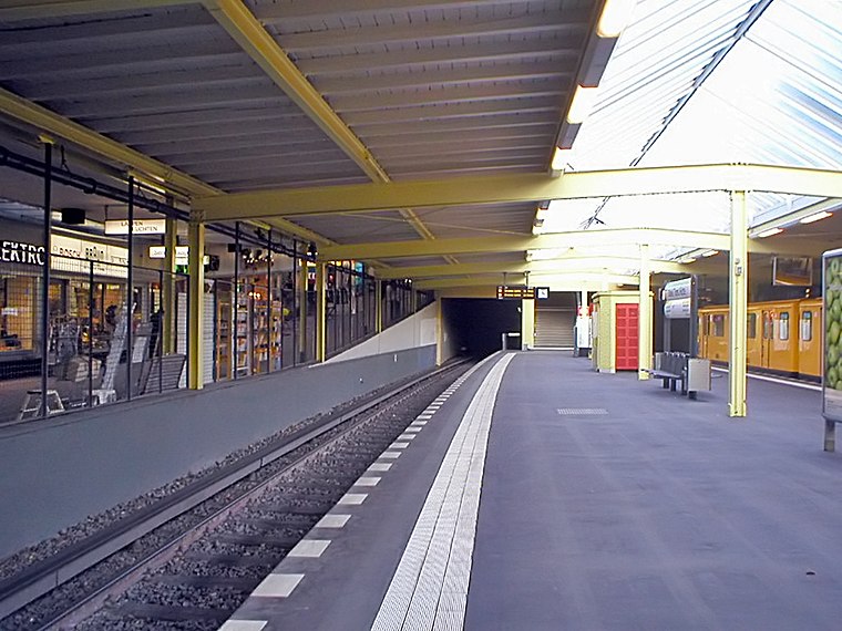
Photo: Jcornelius, CC BY-SA 3.0.
Onkel Toms Hütte is a Berlin U-Bahn station located in the Zehlendorf district. Since 12 December 2004 it is served by the U3 line. Onkel Toms Hütte is situated 340 metres south of Günther Lewinsohn.
Ernst-Moritz-Arndt-Kirche
Church

Photo: Bodo Kubrak, CC0.
Ernst-Moritz-Arndt-Kirche is a church, which is situated 460 metres south of Günther Lewinsohn.
Riemeisterfenn
Nature reserve

Photo: Lienhard Schulz, CC BY-SA 3.0.
Riemeisterfenn is a nature reserve.
Places in the Area
Nearby places include Steglitz-Zehlendorf and Lichterfelde.
Steglitz-Zehlendorf

Photo: Pedelecs, CC BY-SA 3.0.
Steglitz-Zehlendorf is the sixth borough of Berlin, formed in Berlin's 2001 administrative reform by merging the former boroughs of Steglitz and Zehlendorf.
Lichterfelde
Suburb

Photo: Fridolin freudenfett, CC BY-SA 3.0.
Lichterfelde is a locality in the borough of Steglitz-Zehlendorf in Berlin, Germany. Until 2001 it was part of the former borough of Steglitz, along with Steglitz and Lankwitz. Lichterfelde is situated 4½ km east of Günther Lewinsohn.
Künstlerkolonie
Neighborhood

Photo: Rhetorik-Netz, CC BY-SA 3.0.
Künstlerkolonie is a neighborhood, which is situated 4½ km east of Günther Lewinsohn.
Günther Lewinsohn
- Category: historic site
- Location: Berlin, Berlin, Stadt, Berlin, Germany, Central Europe, Europe
- View on OpenStreetMap
Latitude
52.45286° or 52° 27′ 10″ northLongitude
13.25166° or 13° 15′ 6″ eastOpen location code
9F4MF732+4MOpenStreetMap ID
node 12176758028OpenStreetMap feature
historic=memorialOpenStreetMap attribute
wheelchair=yes
This page is based on OpenStreetMap, Wikidata, and Wikimedia Commons.
We’d love your help improving our open data sources. Thank you for contributing.
Satellite Map
Discover Günther Lewinsohn from above in high-definition satellite imagery.
Notable Places Nearby
Highlights include Reiterverein Onkel Toms Hütte and Sun.
Nearby Places
Explore places such as Irene Spur and Helene Schauer.
Berlin: Must-Visit Destinations
Delve into Mitte, East Central, City West, and East Berlin.
Curious Memorials to Discover
Uncover intriguing memorials from every corner of the globe.
About Mapcarta. Data © OpenStreetMap contributors and available under the Open Database License". Text is available under the CC BY-SA 4.0 license, except for photos, directions, and the map. Photo: Berthold Werner, CC BY-SA 3.0.