Karhulavanmäki
Karhulavanmäki is a peak in Tavastia Proper, Southern Finland. Karhulavanmäki is situated nearby to the hamlet Niittymäki, as well as near the locality Pukhuhta.| Tap on a place to explore it |
Places in the Area
Nearby places include Porras.
Porras
Village
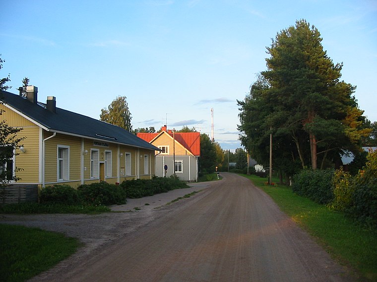
Photo: Urjanhai, CC BY-SA 3.0.
Porras is a village in the municipality of Tammela, Finland. It lies on the Häme Ox Road and has a population of almost 400 inhabitants. An active village, it has about 30 active enterprises and nine unions, a school, cafeteria, and post office services.
Karhulavanmäki
- Type: Peak
- Category: landform
- Location: Tavastia Proper, Southern Finland, Finland, Nordic countries, Europe
- View on OpenStreetMap
Latitude
60.7921° or 60° 47′ 32″ northLongitude
23.9871° or 23° 59′ 14″ eastOpen location code
9GG5QXRP+RROpenStreetMap ID
node 12192641286OpenStreetMap feature
natural=peak
This page is based on OpenStreetMap, Wikidata, and Wikimedia Commons.
We’d love your help improving our open data sources. Thank you for contributing.
Satellite Map
Discover Karhulavanmäki from above in high-definition satellite imagery.
Localities in the Area
Explore places such as Niittymäki and Pukhuhta.
Notable Places Nearby
Highlights include Lapikistonmäki and Kivimäki.
Tavastia Proper: Must-Visit Destinations
Delve into Hämeenlinna, Riihimäki, Forssa, and Janakkala.
Curious Peaks to Discover
Uncover intriguing peaks from every corner of the globe.
About Mapcarta. Data © OpenStreetMap contributors and available under the Open Database License". Text is available under the CC BY-SA 4.0 license, except for photos, directions, and the map. Photo: Wikimedia, CC0.