Extruder (1932)
Extruder (1932) is a historic site in Wuppertal, Düsseldorf, North Rhine-Westphalia. Extruder (1932) is situated nearby to Vulkanisationspresse (1905), as well as near the public building Straßenverkehrsamt, Zulassungsstelle.| Tap on a place to explore it |
Places of Interest Nearby
Highlights include Lichtenplatzer Kapelle and Toelle-Tower.
Lichtenplatzer Kapelle
Church

Photo: Helmut Felder, CC0.
Lichtenplatzer Kapelle is a church, which is situated 290 metres north of Extruder (1932).
Toelle-Tower
Scenic viewpoint

Photo: -wuppertaler, CC BY 4.0.
Toelle-Tower is a scenic viewpoint, which is situated 1¼ km northeast of Extruder (1932).
Waldfrieden Sculpture Park
Museum
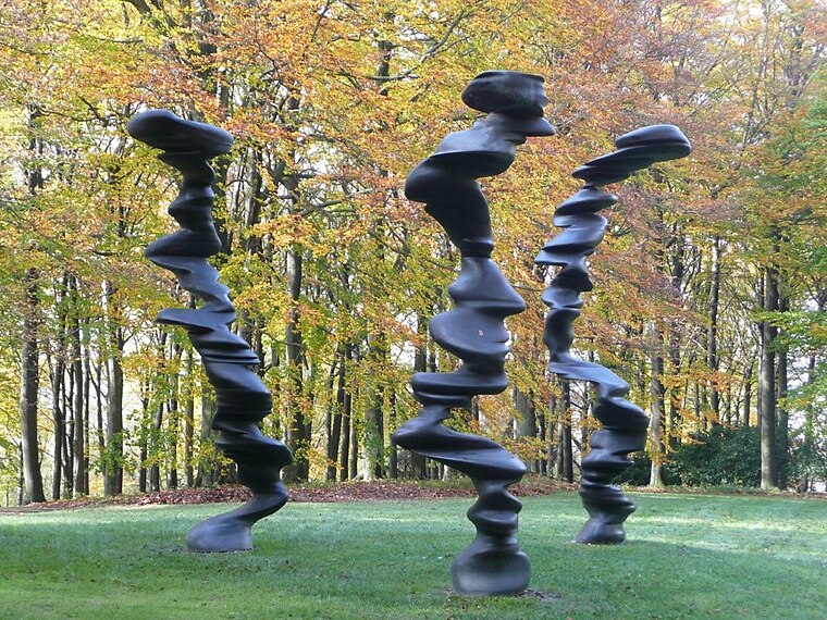
Photo: Gerardus, Public domain.
Waldfrieden Sculpture Park is a museum, which is situated 2 km northwest of Extruder (1932).
Places in the Area
Nearby places include Lichtscheid and Baur.
Lichtscheid
Neighborhood

Photo: Krd, CC BY-SA 4.0.
The Lichtscheid is the highest hill of the German city of Wuppertal. It has an elevation of 350 metres.


Extruder (1932)
- Type: Tourist attraction
- Artwork type: sculpture
- Categories: industry, tourism, and historic site
- Location: Wuppertal, Düsseldorf, Bergisches Land, North Rhine-Westphalia, Germany, Central Europe, Europe
- View on OpenStreetMap
Latitude
51.24604° or 51° 14′ 46″ northLongitude
7.19165° or 7° 11′ 30″ eastOperator
VorwerkOpen location code
9F3965WR+CMOpenStreetMap ID
node 12210602911OpenStreetMap feature
historic=industrialOpenStreetMap feature
man_made=artworkOpenStreetMap feature
tourism=attractionOpenStreetMap attribute
artwork_type=sculpture
This page is based on OpenStreetMap, Wikidata, and Wikimedia Commons.
We’d love your help improving our open data sources. Thank you for contributing.
Satellite Map
Discover Extruder (1932) from above in high-definition satellite imagery.
Notable Places Nearby
Highlights include Vulkanisationspresse (1905) and Straßenverkehrsamt, Zulassungsstelle.
Nearby Places
Explore places such as Scharpenacker Weg and Scharpenacker Weg.
Bergisches Land: Must-Visit Destinations
Delve into Solingen, Bergisch Gladbach, Remscheid, and Gummersbach.
Curious Places to Discover
Uncover intriguing places from every corner of the globe.
About Mapcarta. Data © OpenStreetMap contributors and available under the Open Database License". Text is available under the CC BY-SA 4.0 license, except for photos, directions, and the map. Photo: Wikimedia, CC0.