Rettungswache soH Ost
Rettungswache soH Ost is an ambulance station in Olten, Canton of Solothurn. Rettungswache soH Ost is situated nearby to Hagberg, medieval castle ruins, as well as near the playground Robi-Spielplatz.| Tap on a place to explore it |
Places of Interest Nearby
Highlights include Olten railway station and Concert hall and administration building Olten.
Olten railway station
Railway station

Photo: JoachimKohler-HB, CC BY-SA 4.0.
Olten railway station is a major hub railway station in the canton of Solothurn, Switzerland, at the junction of lines to Zürich, Bern, Basel, Lucerne and Biel. Olten railway station is situated 630 metres southeast of Rettungswache soH Ost.
Concert hall and administration building Olten
Theater building
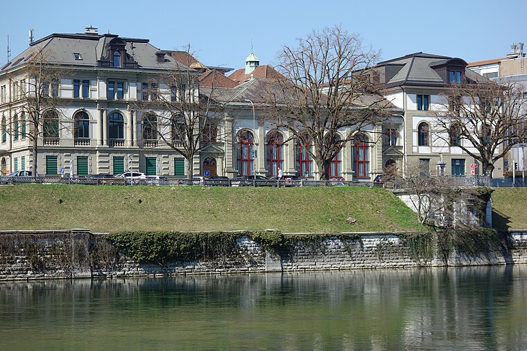
Photo: Paebi, CC BY-SA 4.0.
Concert hall and administration building Olten is a theater building, which is situated 580 metres south of Rettungswache soH Ost.
Municipal library
Library

Photo: Geosketch, CC BY-SA 4.0.
Municipal library is situated 790 metres south of Rettungswache soH Ost.
Places in the Area
Nearby places include Trimbach and Olten.
Trimbach
Village

Photo: DidiWeidmann, CC BY-SA 3.0.
Trimbach is a municipality in the district of Gösgen in the canton of Solothurn in Switzerland.
Olten
Town

Photo: Wikimedia, CC BY-SA 3.0.
Olten is a town in the canton of Solothurn in Switzerland and capital of the district of the same name. Olten grew into a town during the Middle Ages at the location of a bridge over the Aare.
Starrkirch-Wil
Village

Photo: DidiWeidmann, CC BY-SA 3.0.
Starrkirch-Wil is a municipality in the district of Olten in the canton of Solothurn in Switzerland.
Rettungswache soH Ost
- Type: Ambulance station
- Category: health care
- Location: Olten, Olten District, Canton of Solothurn, Switzerland, Central Europe, Europe
- View on OpenStreetMap
Latitude
47.35719° or 47° 21′ 26″ northLongitude
7.90426° or 7° 54′ 15″ eastOperator
soH Solothurner Spitäler AGOpen location code
8FV99W43+VPOpenStreetMap ID
node 12237768175
This page is based on OpenStreetMap, Wikidata, and Wikimedia Commons.
We’d love your help improving our open data sources. Thank you for contributing.
Satellite Map
Discover Rettungswache soH Ost from above in high-definition satellite imagery.
Notable Places Nearby
Highlights include Hagberg, medieval castle ruins and Robi-Spielplatz.
Nearby Places
Explore places such as Personalrestaurant KSO and Bistro Kantonsspital Olten.
Switzerland: Must-Visit Destinations
Delve into Zurich, Berne, Geneva, and Basel.
Curious Ambulance Stations to Discover
Uncover intriguing ambulance stations from every corner of the globe.
About Mapcarta. Data © OpenStreetMap contributors and available under the Open Database License". Text is available under the CC BY-SA 4.0 license, except for photos, directions, and the map. Photo: Simonizer, CC BY-SA 2.0 de.