Brownsville Public Utility Board Administration Building
Brownsville Public Utility Board Administration Building is an electrical substation in Cameron, Texas which is located on Robinhood Drive. Brownsville Public Utility Board Administration Building is situated nearby to The Church of Jesus Christ of Latter Day Saints, as well as near Shepherd of the Valley Lutheran Church.| Tap on a place to explore it |
Places of Interest Nearby
Highlights include Gladys Porter Early College High School and Gladys Porter Zoo.
Gladys Porter Early College High School
School
Gladys Porter Early College High School is a 5A public high school in Brownsville, Texas, United States, and is one of the successors of Brownsville High School. Gladys Porter Early College High School is situated 1 mile south of Brownsville Public Utility Board Administration Building.
Gladys Porter Zoo
Zoo
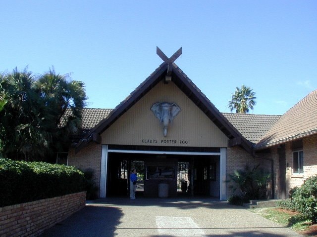
Photo: Jc161991, CC BY-SA 3.0.
Gladys Porter Zoo is a zoological and botanical park located in Brownsville, Texas, United States. The zoo officially opened on September 3, 1971, and currently averages over 424,000 visitors annually. Gladys Porter Zoo is situated 2 miles southwest of Brownsville Public Utility Board Administration Building.
Immaculate Conception Cathedral
Church

Photo: 25or6to4, CC BY-SA 3.0.
Immaculate Conception Cathedral is a historic church at 1218 East Jefferson Street in Brownsville, Texas, United States. It is the cathedral church for the Roman Catholic Diocese of Brownsville. Immaculate Conception Cathedral is situated 2½ miles southwest of Brownsville Public Utility Board Administration Building.
Places in the Area
Nearby places include Brownsville and Cameron Park.
Brownsville

Photo: Carol M. Highsmith, CC0.
Located at the southernmost tip of Texas, Brownsville is a popular location for Mexican and American beach tourists. It is part of the Rio Grande Valley, a four-county region known for its abundance in citrus fruit production and Winter Texan population.
Cameron Park
Town
Cameron Park is a census-designated place in Cameron County, Texas, United States. The population was 6,099 at the 2020 census. It is part of the Brownsville–Harlingen Metropolitan Statistical Area. Cameron Park is situated 3 miles north of Brownsville Public Utility Board Administration Building.
Matamoros

Photo: MX, CC BY-SA 4.0.
Matamoros is a city of 520,000 people in Tamaulipas in Mexico. Matamoros is a major historical site, the site of several battles and events of the Mexican War of Independence, the Mexican Revolution, the Texas Revolution, the Mexican–American War, the American Civil War, and the French Intervention as a result of which the city earned its title of "Undefeated, Loyal, and Heroic".
Brownsville Public Utility Board Administration Building
- Type: Electrical substation
- Address: 1425 Robinhood Drive, Brownsville, TX 78520
- Categories: building and industry
- Location: Cameron, Texas, United States, North America
- View on OpenStreetMap
Latitude
25.92476° or 25° 55′ 29″ northLongitude
-97.46755° or 97° 28′ 3″ westOpen location code
76Q4WGFJ+WXOpenStreetMap ID
node 12244539195OpenStreetMap feature
building=yes
This page is based on OpenStreetMap, Wikidata, and Wikimedia Commons.
We’d love your help improving our open data sources. Thank you for contributing.
Satellite Map
Discover Brownsville Public Utility Board Administration Building from above in high-definition satellite imagery.
Notable Places Nearby
Highlights include The Church of Jesus Christ of Latter Day Saints and Shepherd of the Valley Lutheran Church.
Nearby Places
Explore places such as The Home Depot and Filter Plant Substation.
Texas: Must-Visit Destinations
Delve into Houston, Austin, Dallas, and San Antonio.
Curious Electrical Substations to Discover
Uncover intriguing electrical substations from every corner of the globe.
About Mapcarta. Data © OpenStreetMap contributors and available under the Open Database License". Text is available under the CC BY-SA 4.0 license, except for photos, directions, and the map. Photo: Wikimedia, CC0.