Mittelschule Siegendorf
Mittelschule Siegendorf is a school in Siegendorf, Eisenstadt-Umgebung District, Burgenland which is located on Haydnplatz. Mittelschule Siegendorf is situated nearby to the sports venue ASV Siegendorf, as well as near the water park Freibad Siegendorf.| Tap on a place to explore it |
- Type: School
- Also known as: “Hauptschule Siegendorf” and “MS Siegendorf”
- Address: Haydnplatz 2, Siegendorf, 7011
Places of Interest Nearby
Highlights include Johann Nepomuk-Kapelle and Pfarrkirche zu Allerheiligen, Siegendorf.
Johann Nepomuk-Kapelle
Church

Photo: Steindy, CC BY-SA 3.0.
Johann Nepomuk-Kapelle is a church, which is situated 440 metres southwest of Mittelschule Siegendorf.
Pfarrkirche zu Allerheiligen, Siegendorf
Church

Photo: Steindy, CC BY-SA 3.0.
Pfarrkirche zu Allerheiligen, Siegendorf is a church, which is situated 640 metres southwest of Mittelschule Siegendorf.
Fire station in Siegendorf
Fire station

Photo: Wikimedia, CC BY-SA 4.0.
Fire station in Siegendorf is situated 640 metres west of Mittelschule Siegendorf.
Places in the Area
Nearby places include Baumgarten and Eisenstadt.
Baumgarten
Village

Photo: Christian Pirkl, CC BY-SA 4.0.
Baumgarten is a town in the district of Mattersburg in the Austrian state of Burgenland. Baumgarten is situated 6 km southwest of Mittelschule Siegendorf.
Eisenstadt

Photo: Wikimedia, CC BY-SA 3.0.
Eisenstadt is the state capital of Burgenland in Austria. It consists of 4 districts: Kleinhöflein im Burgenland, Eisenstadt-Oberberg, Eisenstadt-Unterberg and St.
Kleinhöflein im Burgenland
Village
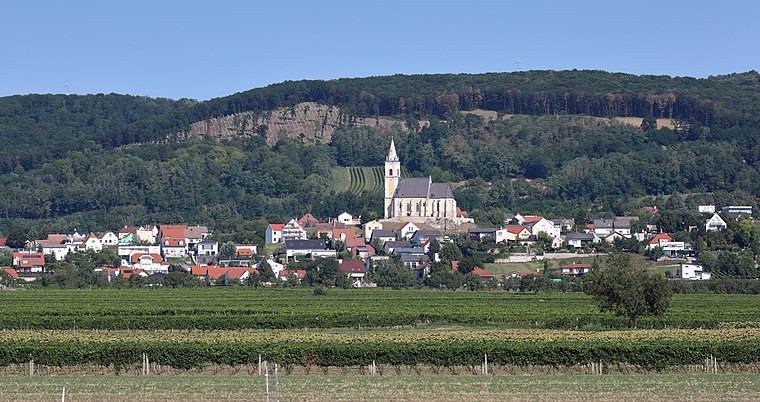
Photo: Bwag, CC BY-SA 4.0.
Kleinhöflein im Burgenland is a village, which is situated 7 km northwest of Mittelschule Siegendorf.
Mittelschule Siegendorf
- Category: education
- Location: Siegendorf, Eisenstadt-Umgebung District, Burgenland, Austria, Central Europe, Europe
- View on OpenStreetMap
Latitude
47.78329° or 47° 46′ 60″ northLongitude
16.54758° or 16° 32′ 51″ eastOpen location code
8FVRQGMX+82OpenStreetMap ID
node 12295850456OpenStreetMap feature
amenity=school
This page is based on OpenStreetMap, Wikidata, and Wikimedia Commons.
We’d love your help improving our open data sources. Thank you for contributing.
Satellite Map
Discover Mittelschule Siegendorf from above in high-definition satellite imagery.
Notable Places Nearby
Highlights include ASV Siegendorf and Freibad Siegendorf.
Nearby Places
Explore places such as Volksschule Siegendorf and Ganztagesschule Siegendorf.
Burgenland: Must-Visit Destinations
Delve into Eisenstadt, Neusiedl am See, Rust, and Güssing.
Curious Schools to Discover
Uncover intriguing schools from every corner of the globe.
About Mapcarta. Data © OpenStreetMap contributors and available under the Open Database License". Text is available under the CC BY-SA 4.0 license, except for photos, directions, and the map. Photo: Wikimedia, CC BY-SA 4.0.