Dwyane Wade
Dwyane Wade is a work of art in Miami-Dade County, Greater Miami, Florida. Dwyane Wade is situated nearby to the stadium Kaseya Center, as well as near Freedom Tower.| Tap on a place to explore it |
Places of Interest Nearby
Highlights include Kaseya Center and Freedom Tower.
Kaseya Center
Stadium
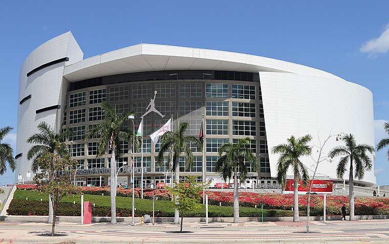 Kaseya Center is a multi-purpose arena on Biscayne Bay in Miami, Florida. The arena is home to the Miami Heat of the National Basketball Association. The arena was previously named American Airlines Arena from opening in 1999 until 2021, FTX Arena from 2021 until 2023, and Miami-Dade Arena during an interim period in 2023.
Freedom Tower
 The Freedom Tower is a building in Miami, Florida. It was designed by Schultze and Weaver and is currently used as a contemporary art museum and a central office to different disciplines in the arts associated with Miami Dade College. Freedom Tower is situated 460 feet southwest of Dwyane Wade.
Pérez Art Museum Miami
Museum

Photo: Wikimedia, CC BY-SA 2.0.
Pérez Art Museum Miami —officially known as the Jorge M. Pérez Art Museum of Miami-Dade County—is a contemporary art museum that relocated in 2013 to the Maurice A. Pérez Art Museum Miami is situated 1,900 feet northeast of Dwyane Wade.
Places in the Area
Nearby places include Miami and Downtown Miami.
Miami

Photo: UpstateNYer, CC BY-SA 3.0.
Miami is a major city in the southeastern United States and the second most populous city in Florida. The Greater Miami metropolitan area is the largest in the state with an estimated population just under 6.1 million, which makes it the 9th most populous metro area in the United States.
Downtown Miami

Photo: Dori, CC BY-SA 3.0.
Downtown Miami is a district in Miami, steel-and-glass buildings have sprung up around downtown, the heart of the city. By day there's plenty of activity downtown, as suited lawyers and bankers share the sidewalks with Latino merchants wearing open-neck, intricately embroidered shirts called guayaberas.
Overtown
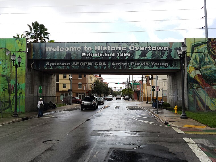
Photo: Pietro, CC BY-SA 3.0.
Overtown is a historically African-American neighborhood located just north of downtown Miami and is considered part of Miami's Central District. It is also Miami’s poorest neighborhood.
Dwyane Wade
- Type: Work of art
- Artwork type: statue
- Category: tourism
- Location: Miami-Dade County, Greater Miami, Florida, United States, North America
- View on OpenStreetMap
Latitude
25.78115° or 25° 46′ 52″ northLongitude
-80.1887° or 80° 11′ 19″ westInception
October 27th, 2024Open location code
76QXQRJ6+FGOpenStreetMap ID
node 12310395544OpenStreetMap feature
tourism=artworkOpenStreetMap attribute
artwork_type=statue
This page is based on OpenStreetMap, Wikidata, and Wikimedia Commons.
We’d love your help improving our open data sources. Thank you for contributing.
Satellite Map
Discover Dwyane Wade from above in high-definition satellite imagery.
Notable Places Nearby
Highlights include Marinablue and Freedom Tower station.
Nearby Places
Explore places such as Biscayne Boulevard & Northeast 7th Street and Biscayne Boulevard & Northeast 6th Street.
Miami-Dade County: Must-Visit Destinations
Delve into Miami, Miami Beach, Hialeah, and South Beach.
Curious Work Of Arts to Discover
Uncover intriguing work of arts from every corner of the globe.
About Mapcarta. Data © OpenStreetMap contributors and available under the Open Database License". Text is available under the CC BY-SA 4.0 license, except for photos, directions, and the map. Photo: Dori, CC BY-SA 3.0.