Jansen Eck
Jansen Eck is a pub in Berlin, Berlin. Jansen Eck is situated nearby to Kirschblütenplatz, as well as near the protected area Siedlung Wittenau.| Tap on a place to explore it |
Places of Interest Nearby
Highlights include Lindenkirche and Thomaskirche.
Lindenkirche
Church

Photo: Bodo Kubrak, CC BY-SA 4.0.
Lindenkirche is a church, which is situated 340 metres southeast of Jansen Eck.
Thomaskirche
Church

Photo: Bodo Kubrak, CC BY-SA 4.0.
Thomaskirche is a church, which is situated 460 metres south of Jansen Eck.
Rathaus Reinickendorf
Town hall
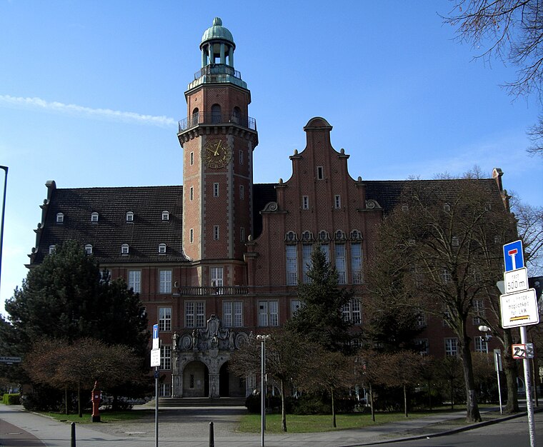
Photo: Havelbaude, CC BY-SA 3.0.
Rathaus Reinickendorf is a town hall, which is situated 1 km northwest of Jansen Eck.
Places in the Area
Nearby places include Cité Foch and White City.

White City
Neighborhood

Photo: LiLaLux, CC BY-SA 4.0.
The White City is a large housing estate with 1268 apartments in Berlin's Reinickendorf district. It is one of the six Berlin Modernism Housing Estates and has been listed as a UNESCO World Heritage Site since 2008.
Schwarzwaldsiedlung
Quarter

Photo: Gunnar Klack, CC BY-SA 4.0.
Schwarzwaldsiedlung is a quarter, which is situated 2½ km north of Jansen Eck.
Jansen Eck
- Type: Pub
- Location: Berlin, Berlin, Stadt, Berlin, Germany, Central Europe, Europe
- View on OpenStreetMap
Latitude
52.58488° or 52° 35′ 6″ northLongitude
13.33433° or 13° 20′ 4″ eastOpen location code
9F4MH8MM+XPOpenStreetMap ID
node 12326494048OpenStreetMap feature
amenity=pub
This page is based on OpenStreetMap, Wikidata, and Wikimedia Commons.
We’d love your help improving our open data sources. Thank you for contributing.
Satellite Map
Discover Jansen Eck from above in high-definition satellite imagery.
Notable Places Nearby
Highlights include Kirschblütenplatz and Siedlung Wittenau.
Nearby Places
Explore places such as Jansenstraße and Jansenstraße.
Berlin: Must-Visit Destinations
Delve into Mitte, East Central, City West, and East Berlin.
Curious Pubs to Discover
Uncover intriguing pubs from every corner of the globe.
About Mapcarta. Data © OpenStreetMap contributors and available under the Open Database License". Text is available under the CC BY-SA 4.0 license, except for photos, directions, and the map. Photo: Berthold Werner, CC BY-SA 3.0.