Vitarelles - Fronde
Vitarelles - Fronde is a bike rental in Toulouse, Haute-Garonne, Occitanie. Vitarelles - Fronde is situated nearby to the sports venue Gymnase Marcel Cerdan, as well as near the castle Château de la Cépière.| Tap on a place to explore it |
Places of Interest Nearby
Highlights include Château de la Cépière and École nationale supérieure d’architecture de Toulouse.
Château de la Cépière
Castle

Photo: Elizloison, CC BY-SA 3.0.
Château de la Cépière is a castle, which is situated 480 metres east of Vitarelles - Fronde.
École nationale supérieure d’architecture de Toulouse
University
The École nationale supérieure d'architecture de Toulouse is a French school of architecture, a unit of the University of Toulouse. École nationale supérieure d’architecture de Toulouse is situated 1 km south of Vitarelles - Fronde.
Château du Mirail
University
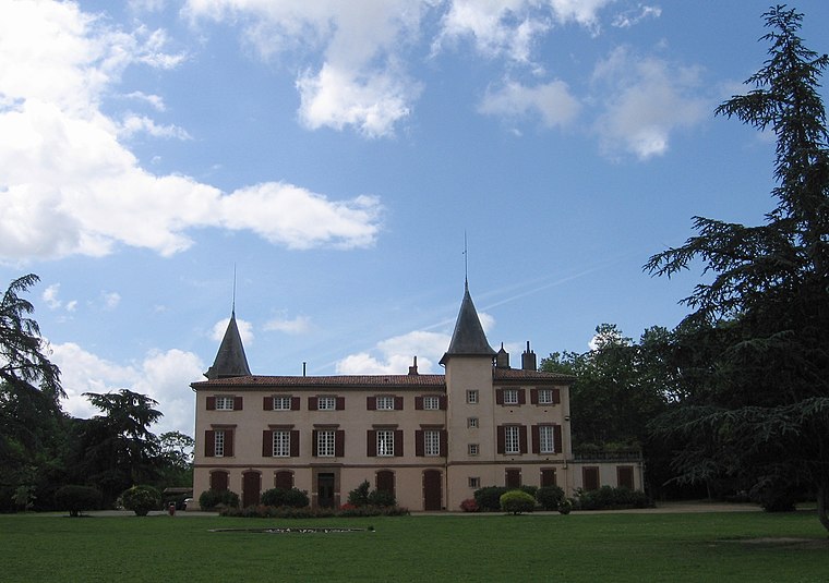
Photo: Wikimedia, Public domain.
The Château du Mirail is a castle in Toulouse. The Château du Mirail was commissioned by Guillaume de Mondran and built in 1680. The 52-hectare surrounding park was landscaped between 1700 and 1720. Château du Mirail is situated 1¼ km south of Vitarelles - Fronde.
Places in the Area
Nearby places include Toulouse La Cépière and Toulouse Lardenne.


Le Mirail
Suburb

Photo: Traumrune, CC BY-SA 3.0.
Le Mirail is a district in Toulouse, France. It was an urban expansion project proposed by the then-mayor Louis Bazerque in 1958, to combat the increasing population, and resulting housing shortage.
Vitarelles - Fronde
- Opening hours: 24/7
- Type: Bike rental
- Category: transportation
- Location: Toulouse, Arrondissement of Toulouse, Haute-Garonne, Occitanie, France, Europe
- View on OpenStreetMap
Latitude
43.58732° or 43° 35′ 14″ northLongitude
1.39462° or 1° 23′ 41″ eastBrand
VélôToulouseOperator
JCDecauxNetwork
VélôToulouseOpen location code
8FM3H9PV+WROpenStreetMap ID
node 12339627607OpenStreetMap feature
amenity=bicycle_rental
This page is based on OpenStreetMap, Wikidata, and Wikimedia Commons.
We’d love your help improving our open data sources. Thank you for contributing.
Satellite Map
Discover Vitarelles - Fronde from above in high-definition satellite imagery.
Notable Places Nearby
Highlights include Gymnase Marcel Cerdan and Château des Vitarelles.
Nearby Places
Explore places such as Vitarelles and Restaurant de l’Ayguette.
Haute-Garonne: Must-Visit Destinations
Delve into Boutx, Tarn, Roquesérière, and Pechbonnieu.
Curious Bike Rentals to Discover
Uncover intriguing bike rentals from every corner of the globe.
About Mapcarta. Data © OpenStreetMap contributors and available under the Open Database License". Text is available under the CC BY-SA 4.0 license, except for photos, directions, and the map. Photo: PierreSelim, CC BY 3.0.