Coney Island Medicaid Office
Coney Island Medicaid Office is a government office in Brooklyn, New York which is located on Mermaid Avenue. Coney Island Medicaid Office is situated nearby to the government office IDNYC, as well as near Supplemental Nutrition Assistance Program.| Tap on a place to explore it |
- Opening hours: Monday—Friday 9:00 AM—5:00 PM
- Type: Government office
- Address: 1912 Mermaid Avenue, Brooklyn, NY 11224
Places of Interest Nearby
Highlights include Maimonides Park and Parachute Jump.
Maimonides Park
Stadium

Photo: Newyorkbob, CC BY-SA 3.0.
Maimonides Park is a minor league baseball stadium on the Riegelmann Boardwalk in the Coney Island neighborhood of Brooklyn in New York City. The home team and primary tenant is the New York Mets-affiliated Brooklyn Cyclones of the South Atlantic League. Maimonides Park is situated 940 feet southeast of Coney Island Medicaid Office.
Parachute Jump
Carousel
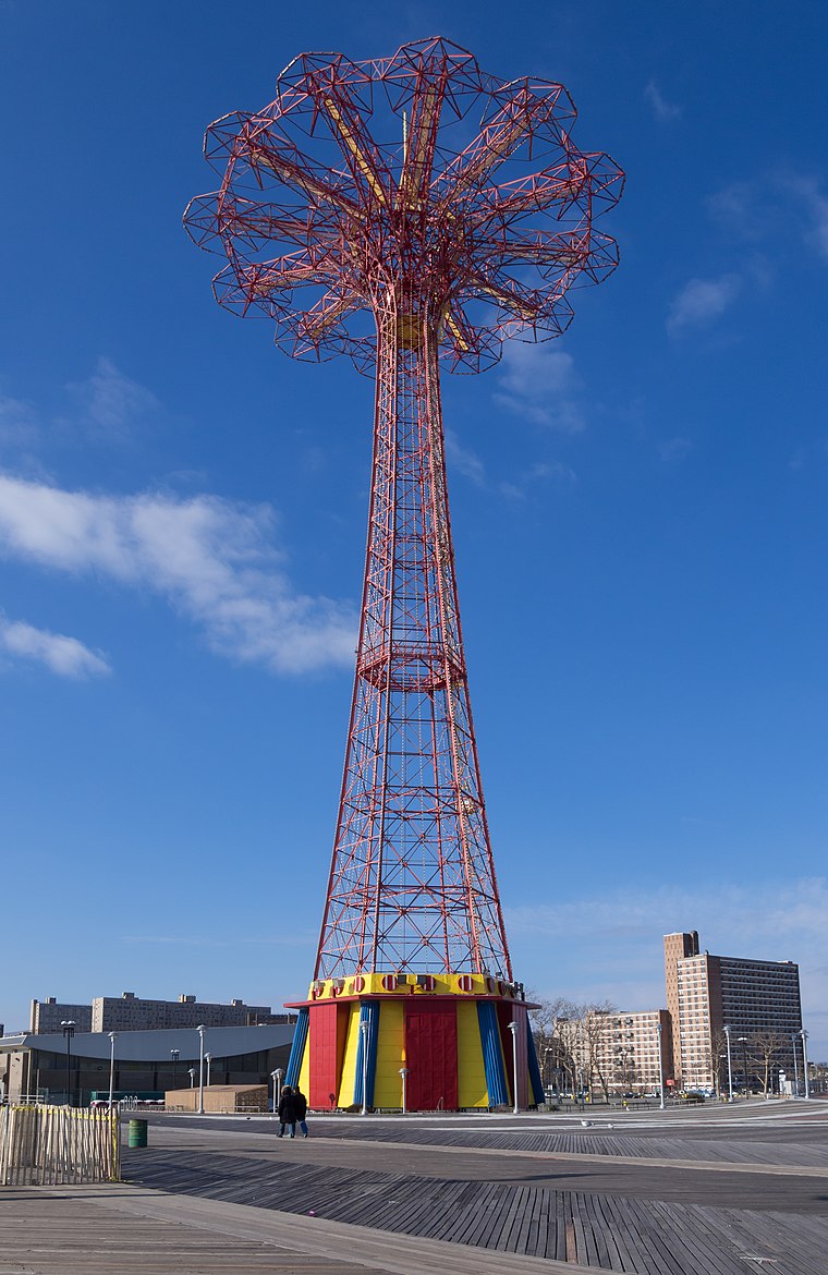
Photo: Rhododendrites, CC BY-SA 4.0.
The Parachute Jump is a defunct amusement ride and a landmark in the New York City borough of Brooklyn, along the Riegelmann Boardwalk at Coney Island. Parachute Jump is situated 1,300 feet southeast of Coney Island Medicaid Office.
Steeplechase Park
Park

Photo: Wikimedia, Public domain.
Steeplechase Park was an amusement park that operated in the Coney Island neighborhood of Brooklyn in New York City, United States, from 1897 to 1964. Steeplechase Park was created by the entrepreneur George C. Steeplechase Park is situated 1,300 feet southeast of Coney Island Medicaid Office.
Places in the Area
Nearby places include Coney Island and Brighton Beach and Sea Gate.
Coney Island and Brighton Beach

Photo: David Reilly, CC BY 2.0.
Coney Island and Brighton Beach are in Brooklyn. In addition to those two neighborhoods, this article covers Manhattan Beach, Gravesend, and Sheepshead Bay.
Sea Gate
Neighborhood

Photo: Wikimedia, Public domain.
Sea Gate is a private gated community at the far western end of Coney Island at the southwestern tip of the New York City borough of Brooklyn. Located on the portion of the Coney Island peninsula west of West 37th Street, it contains mostly single-family homes, some directly on Gravesend Bay.
Brighton Beach
Neighborhood

Photo: Billy Hathorn, CC BY-SA 3.0.
Brighton Beach is a neighborhood in the southern portion of the New York City borough of Brooklyn, within the greater Coney Island area along the Atlantic Ocean coastline.
Coney Island Medicaid Office
- Categories: office and government building
- Location: Brooklyn, New York, Mid-Atlantic, United States, North America
- View on OpenStreetMap
Latitude
40.5763° or 40° 34′ 35″ northLongitude
-73.9863° or 73° 59′ 11″ westBranch
Coney IslandOperator
New York City Human Resources AdministrationOpen location code
87G8H2G7+GFOpenStreetMap ID
node 12407832040OpenStreetMap feature
office=government
This page is based on OpenStreetMap, Wikidata, and Wikimedia Commons.
We’d love your help improving our open data sources. Thank you for contributing.
Satellite Map
Discover Coney Island Medicaid Office from above in high-definition satellite imagery.
Notable Places Nearby
Highlights include Supplemental Nutrition Assistance Program and IDNYC.
Nearby Places
Explore places such as Mermaid Avenue & West 19th Street and C&T Nail Salon.
Brooklyn: Must-Visit Destinations
Delve into Coney Island and Brighton Beach, Southwest Brooklyn, Williamsburg, and Downtown Brooklyn.
Curious Government Offices to Discover
Uncover intriguing government offices from every corner of the globe.
About Mapcarta. Data © OpenStreetMap contributors and available under the Open Database License". Text is available under the CC BY-SA 4.0 license, except for photos, directions, and the map. Photo: Suiseiseki, CC BY-SA 3.0.