Alto de la Corra
Alto de la Corra is a locality in Villanueva de las Cruces, Huelva, Andalusia. Alto de la Corra is situated nearby to the locality Cabezo del Membrillo, as well as near La Charneca.| Tap on a place to explore it |
Places of Interest
Highlights include Iglesia Parroquial Santa María de la Cruz.
Iglesia Parroquial Santa María de la Cruz
Church
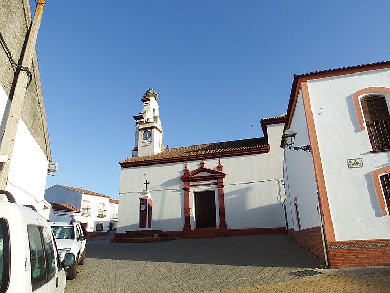
Photo: 19Tarrestnom65, CC BY-SA 4.0.
Iglesia Parroquial Santa María de la Cruz is a church, which is situated 3½ km north of Alto de la Corra.
Places in the Area
Nearby places include Villanueva de las Cruces and Tharsis.
Villanueva de las Cruces
Village

Photo: Abraham del pozo, CC BY-SA 3.0.
Villanueva de las Cruces is a town and municipality located in the province of Huelva, Spain. According to the 2007 census, the municipality had a population of 416 inhabitants. Villanueva de las Cruces is situated 3½ km north of Alto de la Corra.
Tharsis
Village
 Tharsis is a village that is part of the Alosno municipality in the province of Huelva, Spain. According to the 2013 census, the village has a population of 1,840 inhabitants. Tharsis is situated 9 km west of Alto de la Corra.
Alto de la Corra
- Type: Locality
- Location: Villanueva de las Cruces, Huelva, Andalusia, Spain, Iberia, Europe
- View on OpenStreetMap
Latitude
37.59953° or 37° 35′ 58″ northLongitude
-7.01376° or 7° 0′ 50″ westOpen location code
8C9JHXXP+RFOpenStreetMap ID
node 1241334581OpenStreetMap feature
place=locality
This page is based on OpenStreetMap, Wikidata, and Wikimedia Commons.
We’d love your help improving our open data sources. Thank you for contributing.
Satellite Map
Discover Alto de la Corra from above in high-definition satellite imagery.
Places with the Same Name
Discover other places named “Alto de la Corra”.
Localities in the Area
Explore places such as Cabezo del Membrillo and Alto de la Corralada.
Notable Places Nearby
Highlights include Oficina de Correos and Ayuntamiento de Villanueva de las Cruces.
Huelva: Must-Visit Destinations
Delve into Huelva, Palos de la Frontera, Culturally significant landscapes in Huelva, and Almonaster la Real.
Curious Localities to Discover
Uncover intriguing localities from every corner of the globe.
About Mapcarta. Data © OpenStreetMap contributors and available under the Open Database License". Text is available under the CC BY-SA 4.0 license, except for photos, directions, and the map. Photo: Wikimedia, CC0.