Closa de Dalt
Closa de Dalt is a locality in Palau-saverdera, Girona, Catalonia. Closa de Dalt is situated nearby to the hamlet les Torroelles, as well as near the locality el Molí del Vent.| Tap on a place to explore it |
Places of Interest
Highlights include Castell de Vilaüt and Església de Sant Joan de Palau-saverdera.

Església de Sant Joan de Palau-saverdera
Church

Photo: Wikimedia, CC BY-SA 3.0.
Església de Sant Joan de Palau-saverdera is a church, which is situated 3 km northeast of Closa de Dalt.
Santa Maria, Roses
Monastery
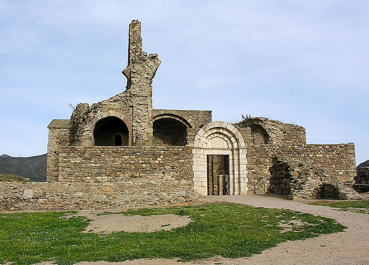 Santa Maria de Roses is a ruined Benedictine monastery in the municipality of Roses, Alt Empordà comarca, Catalonia, Spain. It is situated within the Ciutadella de Roses, a fortification in the Province of Girona. Santa Maria, Roses is situated 4 km southeast of Closa de Dalt.
Places in the Area
Nearby places include Vilaüt and Pau.
Pau
Village

Photo: Wikimedia, CC BY-SA 3.0.
Pau is a municipality in the comarca of Alt Empordà, Girona, Catalonia, Spain. Pau is situated 4 km north of Closa de Dalt.
Empuriabrava

Photo: Wikimedia, CC BY-SA 4.0.
Empuriabrava is a tourist area of 1 Castelló d'Empúries town approximately 120 km northeast of Barcelona on the coast of Girona in Catalonia. The town is home to one of the world's largest man-made marinas with channels cutting through the whole northern part of the urban area.
Closa de Dalt
- Type: Locality
- Location: Palau-saverdera, Girona, Catalonia, Eastern Spain, Spain, Iberia, Europe
- View on OpenStreetMap
Latitude
42.28236° or 42° 16′ 57″ northLongitude
3.12693° or 3° 7′ 37″ eastOpen location code
8FJ574JG+WQOpenStreetMap ID
node 1241583309OpenStreetMap feature
place=locality
This page is based on OpenStreetMap, Wikidata, and Wikimedia Commons.
We’d love your help improving our open data sources. Thank you for contributing.
Satellite Map
Discover Closa de Dalt from above in high-definition satellite imagery.
In Other Languages
“Closa de Dalt” goes by many names.
- Catalan: “Closa de Dalt”
Localities in the Area
Explore places such as les Torroelles and el Molí del Vent.
Notable Places Nearby
Highlights include Estany de Vilaüt and Bassa Rodona.
Girona: Must-Visit Destinations
Delve into Girona, Figueres, Llivia, and Lloret de Mar.
Curious Localities to Discover
Uncover intriguing localities from every corner of the globe.
About Mapcarta. Data © OpenStreetMap contributors and available under the Open Database License". Text is available under the CC BY-SA 4.0 license, except for photos, directions, and the map. Photo: Wikimedia, CC0.