Malh de Castèth
Malh de Castèth is a locality in Vielha e Mijaran, Lleida, Catalonia. Malh de Castèth is situated nearby to the locality Estremesaigües, as well as near Bòsc de Arró.| Tap on a place to explore it |
Places of Interest
Highlights include Castell Lleó and Mare de Déu del Roser de les Bordes.

Mare de Déu del Roser de les Bordes
Church

Photo: Jordiferrer, CC BY-SA 3.0.
Mare de Déu del Roser de les Bordes is a church.
Sant Fabià d’Arres de Jos
Church

Photo: Wikimedia, Public domain.
Sant Fabià d’Arres de Jos is a church.
Places in the Area
Nearby places include Arró and Es Bòrdes.
Arró
Hamlet

Photo: Wikimedia, CC BY-SA 4.0.
Arró is a village located in the municipality of Es Bòrdes, Catalonia. It was an independent municipality before 1847.
Es Bòrdes
Village
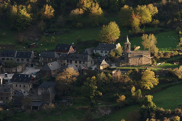
Photo: Amadalvarez, CC BY-SA 3.0.
Es Bòrdes is a municipality in western Aran, Catalonia. It has a population of 280. The mayor is Rosa Mirat Marqués. The municipality includes a small exclave to the west. It is located in the terçon of Irissa.

Malh de Castèth
- Type: Locality
- Location: Vielha e Mijaran, Lleida, Catalonia, Eastern Spain, Spain, Iberia, Europe
- View on OpenStreetMap
Latitude
42.73733° or 42° 44′ 14″ northLongitude
0.70434° or 0° 42′ 16″ eastOpen location code
8FJ2PPP3+WPOpenStreetMap ID
node 1241624550OpenStreetMap feature
place=locality
This page is based on OpenStreetMap, Wikidata, and Wikimedia Commons.
We’d love your help improving our open data sources. Thank you for contributing.
Satellite Map
Discover Malh de Castèth from above in high-definition satellite imagery.
Localities in the Area
Explore places such as Estremesaigües and Bòsc de Arró.
Notable Places Nearby
Highlights include Casa de la Vila and Sant Martin.
Lleida: Must-Visit Destinations
Delve into Lleida, Val d’Aran, La Seu d’Urgell, and Aigüestortes i Estany de Sant Maurici National Park.
Curious Localities to Discover
Uncover intriguing localities from every corner of the globe.
About Mapcarta. Data © OpenStreetMap contributors and available under the Open Database License". Text is available under the CC BY-SA 4.0 license, except for photos, directions, and the map. Photo: Wikimedia, CC0.