Cerro de Juan Ares
Cerro de Juan Ares is a locality in Osuna, Seville, Andalusia. Cerro de Juan Ares is situated nearby to the locality La Peyona, as well as near Las Enredaderas.| Tap on a place to explore it |
Places of Interest
Highlights include Museo de Osuna and Torre del Agua.
Museo de Osuna
Museum

Photo: Wikimedia, CC BY-SA 3.0.
Museo de Osuna is a museum, which is situated 3½ km northeast of Cerro de Juan Ares.
Torre del Agua
Museum

Photo: Wikimedia, CC BY-SA 3.0.
Torre del Agua is a museum, which is situated 4 km east of Cerro de Juan Ares.
Colegiata de Nuestra Señora de la Asunción
Church

Photo: Aapo Haapanen, CC BY 2.0.
The Colegiata de Nuestra Señora de la Asunción is a Catholic church built in the sixteenth century in the town of Osuna, in Andalusia, Spain. It was founded by Juan Téllez-Girón, 4th Count of Ureña. Colegiata de Nuestra Señora de la Asunción is situated 4 km east of Cerro de Juan Ares.
Places in the Area
Nearby places include Osuna.
Osuna
Town
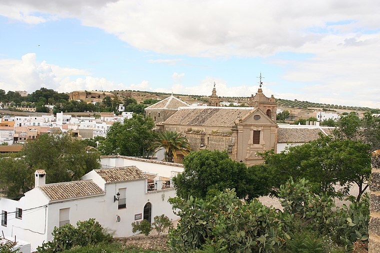
Photo: Wikimedia, CC BY-SA 2.0.
Osuna is a town and municipality in the province of Seville, southern Spain, in the autonomous community of Andalusia. As of 2009, it has a population of c. Osuna is situated 3½ km east of Cerro de Juan Ares.
Cerro de Juan Ares
Latitude
37.22535° or 37° 13′ 31″ northLongitude
-5.14241° or 5° 8′ 33″ westOpen location code
8C9P6VG5+42OpenStreetMap ID
node 1241627258OpenStreetMap feature
place=locality
This page is based on OpenStreetMap, Wikidata, and Wikimedia Commons.
We’d love your help improving our open data sources. Thank you for contributing.
Satellite Map
Discover Cerro de Juan Ares from above in high-definition satellite imagery.
Localities in the Area
Explore places such as La Peyona and Las Enredaderas.
Notable Places Nearby
Highlights include Parque de Bomberos de Osuna and Osuna train station.
Seville: Must-Visit Destinations
Delve into Seville, Santiponce, and Sierra Norte.
Curious Localities to Discover
Uncover intriguing localities from every corner of the globe.
About Mapcarta. Data © OpenStreetMap contributors and available under the Open Database License". Text is available under the CC BY-SA 4.0 license, except for photos, directions, and the map. Photo: Wikimedia, CC0.