Coma de la Creu
Coma de la Creu is a locality in Nalec, Lleida, Catalonia. Coma de la Creu is situated nearby to the locality Bassa de la Comallonga, as well as near Valernes.| Tap on a place to explore it |
Places of Interest
Highlights include Sant Jaume de Nalec and Transfiguració de Rocafort de Vallbona.

Transfiguració de Rocafort de Vallbona
Church

Photo: Enric, CC BY-SA 4.0.
Transfiguració de Rocafort de Vallbona is a church.
Església de Sant Martí de Maldà
Church

Photo: Enric, CC BY-SA 4.0.
Església de Sant Martí de Maldà is a church, which is situated 4 km southwest of Coma de la Creu.
Places in the Area
Nearby places include Rocafort de Vallbona and El Vilet.

El Vilet
Hamlet
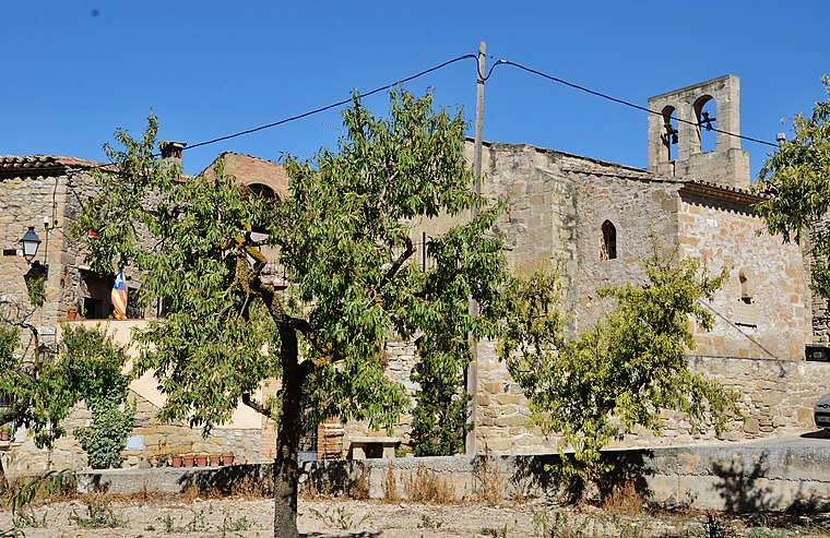
Photo: MARIA ROSA FERRE ✿, CC BY-SA 2.0.
El Vilet is a hamlet, which is situated 3 km southwest of Coma de la Creu.
Sant Martí de Maldà
Village

Photo: Enric, CC BY-SA 4.0.
Sant Martí de Maldà is a village, which is situated 4 km southwest of Coma de la Creu.
Coma de la Creu
- Type: Locality
- Location: Nalec, Lleida, Catalonia, Eastern Spain, Spain, Iberia, Europe
- View on OpenStreetMap
Latitude
41.57598° or 41° 34′ 34″ northLongitude
1.09581° or 1° 5′ 45″ eastOpen location code
8FH3H3GW+98OpenStreetMap ID
node 1241668649OpenStreetMap feature
place=locality
This page is based on OpenStreetMap, Wikidata, and Wikimedia Commons.
We’d love your help improving our open data sources. Thank you for contributing.
Satellite Map
Discover Coma de la Creu from above in high-definition satellite imagery.
In Other Languages
“Coma de la Creu” goes by many names.
- Catalan: “Coma de la Creu”
Localities in the Area
Explore places such as Bassa de la Comallonga and Valernes.
Notable Places Nearby
Highlights include Puig Pelat and Plaça de la República.
Lleida: Must-Visit Destinations
Delve into Lleida, Val d’Aran, La Seu d’Urgell, and Aigüestortes i Estany de Sant Maurici National Park.
Curious Localities to Discover
Uncover intriguing localities from every corner of the globe.
About Mapcarta. Data © OpenStreetMap contributors and available under the Open Database License". Text is available under the CC BY-SA 4.0 license, except for photos, directions, and the map. Photo: Wikimedia, CC0.