l’Aixaragall
l’Aixaragall is a locality in Vallbona de les Monges, Lleida, Catalonia. l’Aixaragall is situated nearby to the locality les Collades, as well as near lo Socarrat.| Tap on a place to explore it |
Places of Interest
Highlights include Castell de Maldà and Sant Pere de Maldà.
Castell de Maldà
Castle
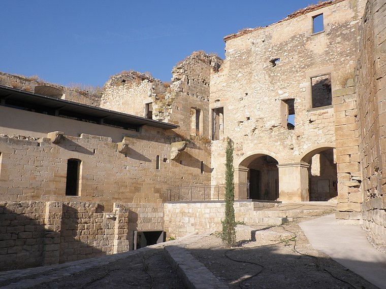
Photo: Wikimedia, Public domain.
Castell de Maldà is a castle, which is situated 2½ km north of l’Aixaragall.
Sant Pere de Maldà
Church

Photo: Adatvi 91, Public domain.
Sant Pere de Maldà is a church, which is situated 2½ km north of l’Aixaragall.
Santa Maria de Maldà
Church

Photo: Adatvi 91, Public domain.
Santa Maria de Maldà is a church, which is situated 2½ km north of l’Aixaragall.
Places in the Area
Nearby places include Llorenç de Rocafort and Maldà.
Llorenç de Rocafort
Hamlet

Photo: Sanclars21, CC BY-SA 4.0.
Llorenç de Rocafort is a hamlet, which is situated 2½ km east of l’Aixaragall.
Maldà
Village

Photo: Adatvi 91, Public domain.
Maldà is a municipality in the comarca of Urgell, Catalonia, Spain. It has a population of 236. Maldà is situated 2½ km north of l’Aixaragall.
Sant Martí de Maldà
Village

Photo: Enric, CC BY-SA 4.0.
Sant Martí de Maldà is a village, which is situated 4 km north of l’Aixaragall.
l’Aixaragall
- Type: Locality
- Location: Vallbona de les Monges, Lleida, Catalonia, Eastern Spain, Spain, Iberia, Europe
- View on OpenStreetMap
Latitude
41.52693° or 41° 31′ 37″ northLongitude
1.03912° or 1° 2′ 21″ eastOpen location code
8FH3G2GQ+QJOpenStreetMap ID
node 1241677522OpenStreetMap feature
place=locality
This page is based on OpenStreetMap, Wikidata, and Wikimedia Commons.
We’d love your help improving our open data sources. Thank you for contributing.
Satellite Map
Discover l’Aixaragall from above in high-definition satellite imagery.
In Other Languages
“l’Aixaragall” goes by many names.
- Catalan: “l’Aixaragall”
Places with the Same Name
Discover other places named “l’Aixaragall”.
Localities in the Area
Explore places such as les Collades and Pla del Picot.
Notable Places Nearby
Highlights include Tossal del Picot and Mas de les Setze.
Lleida: Must-Visit Destinations
Delve into Lleida, Val d’Aran, La Seu d’Urgell, and Aigüestortes i Estany de Sant Maurici National Park.
Curious Localities to Discover
Uncover intriguing localities from every corner of the globe.
About Mapcarta. Data © OpenStreetMap contributors and available under the Open Database License". Text is available under the CC BY-SA 4.0 license, except for photos, directions, and the map. Photo: Wikimedia, CC0.