lo Cap del Terme
lo Cap del Terme is a locality in Lleida, Catalonia. lo Cap del Terme is situated nearby to the locality les Pedreres, as well as near Pla dels Estinclells.| Tap on a place to explore it |
Places of Interest
Highlights include Mare de Déu de Montalbà and Sant Llorenç de Preixana.
Mare de Déu de Montalbà
Church

Photo: Wikimedia, Public domain.
Mare de Déu de Montalbà is a church, which is situated 3 km northwest of lo Cap del Terme.
Sant Llorenç de Preixana
Church

Photo: Isidre blanc, CC BY-SA 4.0.
Sant Llorenç de Preixana is a church, which is situated 3½ km northwest of lo Cap del Terme.
Santa Maria de Preixana
Church

Photo: Isidre blanc, CC BY-SA 4.0.
Santa Maria de Preixana is a church, which is situated 4 km northwest of lo Cap del Terme.
Places in the Area
Nearby places include El Vilet and Preixana.
El Vilet
Hamlet
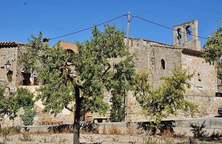
Photo: MARIA ROSA FERRE ✿, CC BY-SA 2.0.
El Vilet is a hamlet, which is situated 3½ km south of lo Cap del Terme.
Preixana
Village

Photo: Wikimedia, Public domain.
Preixana is a village in the province of Lleida and autonomous community of Catalonia, Spain. It has a population of 406. Preixana is situated 3½ km northwest of lo Cap del Terme.
Sant Martí de Maldà
Village

Photo: Enric, CC BY-SA 4.0.
Sant Martí de Maldà is a village, which is situated 4 km southwest of lo Cap del Terme.
lo Cap del Terme
- Type: Locality
- Location: Lleida, Catalonia, Eastern Spain, Spain, Iberia, Europe
- View on OpenStreetMap
Latitude
41.58944° or 41° 35′ 22″ northLongitude
1.07648° or 1° 4′ 35″ eastOpen location code
8FH3H3QG+QHOpenStreetMap ID
node 1241690926OpenStreetMap feature
place=locality
This page is based on OpenStreetMap, Wikidata, and Wikimedia Commons.
We’d love your help improving our open data sources. Thank you for contributing.
Satellite Map
Discover lo Cap del Terme from above in high-definition satellite imagery.
In Other Languages
“lo Cap del Terme” goes by many names.
- Catalan: “lo Cap del Terme”
Places with the Same Name
Discover other places named “lo Cap del Terme”.
Localities in the Area
Explore places such as les Pedreres and Pla dels Estinclells.
Notable Places Nearby
Highlights include Estinclells de Verdú and Parc de l’Ermita de Montalbà.
Lleida: Must-Visit Destinations
Delve into Lleida, Val d’Aran, La Seu d’Urgell, and Aigüestortes i Estany de Sant Maurici National Park.
Curious Localities to Discover
Uncover intriguing localities from every corner of the globe.
About Mapcarta. Data © OpenStreetMap contributors and available under the Open Database License". Text is available under the CC BY-SA 4.0 license, except for photos, directions, and the map. Photo: Wikimedia, CC0.