los Libertells
los Libertells is a locality in Tarragona, Catalonia. los Libertells is situated nearby to the locality los Cóssos, as well as near Marigós.| Tap on a place to explore it |
Places of Interest
Highlights include Santa Magdalena de Batea and Sant Joan Baptista de Batea.
Santa Magdalena de Batea
Church

Photo: MARIA ROSA FERRE ✿, CC BY-SA 2.0.
Santa Magdalena de Batea is a church.
Sant Joan Baptista de Batea
Church

Photo: MARIA ROSA FERRE ✿, CC BY-SA 2.0.
Sant Joan Baptista de Batea is a church.

Places in the Area
Nearby places include Batea Municipality and Caseres Municipality.
Batea Municipality
Village

Photo: Wikimedia, CC BY-SA 3.0.
Batea is a municipality in the comarca of Terra Alta, Catalonia, Spain. It has a population of 1,877. Batea produces good-quality wine that has not reached high prices in the market and is mainly used for local daily consumption in the region.
Caseres Municipality
Village

Photo: Wikimedia, CC BY-SA 3.0.
Caseres is a municipality in the comarca of la Terra Alta in Catalonia, Spain. It has a population of 240. This town is located in picturesque surroundings, but many wind turbines are being constructed in the Serra dels Pesells hills nearby. Caseres Municipality is situated 7 km southwest of los Libertells.
Bot Municipality
Village
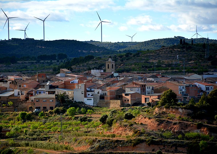
Photo: Wikimedia, CC BY-SA 2.0.
Bot is a town located in the comarca of Terra Alta, province of Tarragona, in Catalonia, Spain. It is located between the Serra de la Solsida and the Serra dels Pesells ranges. Bot Municipality is situated 9 km southeast of los Libertells.
los Libertells
- Type: Locality
- Location: Tarragona, Catalonia, Eastern Spain, Spain, Iberia, Europe
- View on OpenStreetMap
Latitude
41.07399° or 41° 4′ 26″ northLongitude
0.31938° or 0° 19′ 10″ eastOpen location code
8FH238F9+HQOpenStreetMap ID
node 1241758802OpenStreetMap feature
place=locality
This page is based on OpenStreetMap, Wikidata, and Wikimedia Commons.
We’d love your help improving our open data sources. Thank you for contributing.
Satellite Map
Discover los Libertells from above in high-definition satellite imagery.
Localities in the Area
Explore places such as los Cóssos and Marigós.
Notable Places Nearby
Highlights include Bassa de les Forques and Tossal de les Forques.
Tarragona: Must-Visit Destinations
Delve into Tarragona, Reus, Tortosa, and Salou.
Curious Localities to Discover
Uncover intriguing localities from every corner of the globe.
About Mapcarta. Data © OpenStreetMap contributors and available under the Open Database License". Text is available under the CC BY-SA 4.0 license, except for photos, directions, and the map. Photo: Lluket, CC BY-SA 3.0.