los Abeuradors
los Abeuradors is a locality in Vilalba dels Arcs, Tarragona, Catalonia. los Abeuradors is situated nearby to the locality la Jossana, as well as near los Cirerers.| Tap on a place to explore it |
Places of Interest
Highlights include Ermita de la Mare de Déu dels Dolors and Capella de la Mare de Déu de Montserrat.
Ermita de la Mare de Déu dels Dolors

Photo: Jordi G, CC BY-SA 4.0.
Ermita de la Mare de Déu dels Dolors is situated 2½ km south of los Abeuradors.
Capella de la Mare de Déu de Montserrat
Church
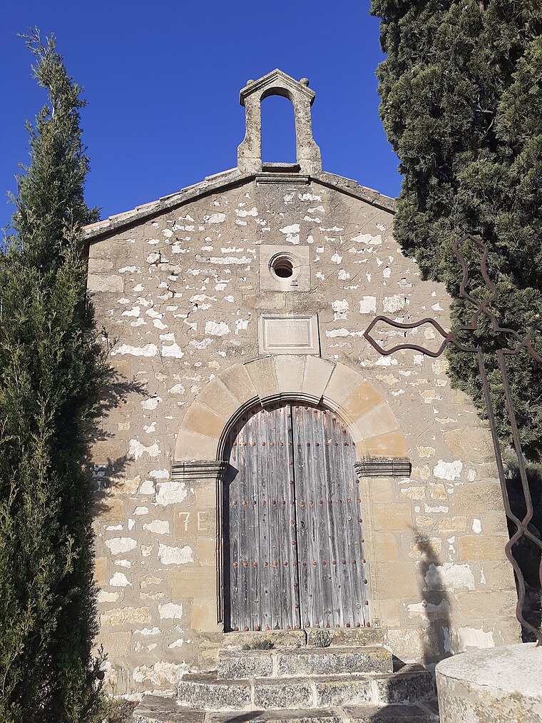
Photo: Jordi G, CC BY-SA 4.0.
Capella de la Mare de Déu de Montserrat is a church, which is situated 2½ km south of los Abeuradors.
Cementiri de Vilalba dels Arcs
Cemetery

Photo: Jordi G, CC BY-SA 4.0.
Cementiri de Vilalba dels Arcs is a cemetery, which is situated 2½ km south of los Abeuradors.
Places in the Area
Nearby places include Rentadors-font and la Fatarella Municipality.

la Fatarella Municipality
Village

Photo: Manel Zaera, CC BY-SA 2.0.
La Fatarella is a municipality in northern Terra Alta, within the region of Ribera d'Ebre in Spain. It has a population of 852. la Fatarella Municipality is situated 6 km east of los Abeuradors.
La Pobla de Massaluca
Village

Photo: Xufanc, CC BY-SA 3.0.
La Pobla de Massaluca is a municipality in the comarca of la Terra Alta in Catalonia, Spain. It has a population of 344. The present town originated in 1294 according to existing documents, but it does not match the present location of the village. La Pobla de Massaluca is situated 6 km northwest of los Abeuradors.
los Abeuradors
- Type: Locality
- Location: Vilalba dels Arcs, Tarragona, Catalonia, Eastern Spain, Spain, Iberia, Europe
- View on OpenStreetMap
Latitude
41.14377° or 41° 8′ 38″ northLongitude
0.40567° or 0° 24′ 20″ eastOpen location code
8FH24CV4+G7OpenStreetMap ID
node 1241766498OpenStreetMap feature
place=locality
This page is based on OpenStreetMap, Wikidata, and Wikimedia Commons.
We’d love your help improving our open data sources. Thank you for contributing.
Satellite Map
Discover los Abeuradors from above in high-definition satellite imagery.
In Other Languages
“los Abeuradors” goes by many names.
- Catalan: “los Abeuradors”
Places with the Same Name
Discover other places named “los Abeuradors”.
Localities in the Area
Explore places such as la Jossana and los Cirerers.
Notable Places Nearby
Highlights include Mas de la Victorina and Mas de Ramonet.
Tarragona: Must-Visit Destinations
Delve into Tarragona, Reus, Tortosa, and Salou.
Curious Localities to Discover
Uncover intriguing localities from every corner of the globe.
About Mapcarta. Data © OpenStreetMap contributors and available under the Open Database License". Text is available under the CC BY-SA 4.0 license, except for photos, directions, and the map. Photo: Lluket, CC BY-SA 3.0.