Tossal de Quatre Bogues
Tossal de Quatre Bogues is a peak in Montanuy, Huesca, Aragon and has an elevation of 1,550 metres. Tossal de Quatre Bogues is situated nearby to the locality L’Avetosa, as well as near the hamlet Ardanuy.| Tap on a place to explore it |
Places of Interest
Highlights include Santuari de la Mare de Déu de Riupedrós and Sant Climent de Vilaller.
Santuari de la Mare de Déu de Riupedrós
Church

Photo: ESM, CC BY-SA 4.0.
Santuari de la Mare de Déu de Riupedrós is a church.


Places in the Area
Nearby places include Vilaller and Laspaúles.
Vilaller
Village

Photo: Efrainlarrea, CC BY-SA 3.0 es.
Vilaller is a town and municipality in Alta Ribagorça county in Catalonia. Besides from the town of Vilaller, the municipality comprises the hamlet of Senet de Barravés and the old stable of Cierco, the latter is abandoned: only Senet and Vilaller have permanent population.
Laspaúles
Village

Photo: Amokk.zgz, CC BY-SA 4.0.
Laspaúles, in Ribagorçan: Laspaúls, or in Aragonese: Las Pauls, is a municipality located in the province of Huesca, Aragon, Spain. According to the 2004 census, the municipality has a population of 277 inhabitants.
Bonansa Municipality
Village
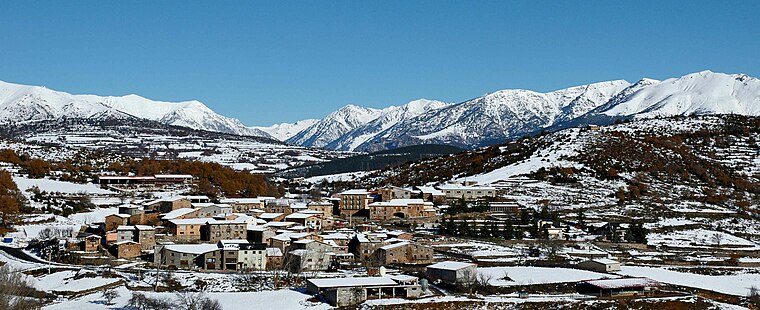
Photo: Baliera, CC BY-SA 3.0.
Bonansa is a municipality located in the province of Huesca, Aragon, Spain. According to the 2010 census, the municipality has a population of 102 inhabitants.
Tossal de Quatre Bogues
- Type: Peak with an elevation of 1,550 metres
- Category: landform
- Location: Montanuy, Huesca, Aragon, Northern Spain, Spain, Iberia, Europe
- View on OpenStreetMap
Latitude
42.4814° or 42° 28′ 53″ northLongitude
0.6692° or 0° 40′ 9″ eastElevation
1,550 metres (5,085 feet)Open location code
8FJ2FMJ9+GMOpenStreetMap ID
node 1241869703OpenStreetMap feature
natural=peak
This page is based on OpenStreetMap, Wikidata, and Wikimedia Commons.
We’d love your help improving our open data sources. Thank you for contributing.
Satellite Map
Discover Tossal de Quatre Bogues from above in high-definition satellite imagery.
In Other Languages
“Tossal de Quatre Bogues” goes by many names.
- Catalan: “Tossal de Quatre Bogues”
Localities in the Area
Explore places such as L’Avetosa and Ardanuy.
Notable Places Nearby
Highlights include Collado de Benifons and Coll de la Forca.
Aragon: Must-Visit Destinations
Delve into Zaragoza, Huesca, Teruel, and Calatayud.
Curious Peaks to Discover
Uncover intriguing peaks from every corner of the globe.
About Mapcarta. Data © OpenStreetMap contributors and available under the Open Database License". Text is available under the CC BY-SA 4.0 license, except for photos, directions, and the map. Photo: LSanzSal, CC BY-SA 3.0 es.