Lomas del Pericón
Lomas del Pericón is a locality in Barbate, Cádiz, Andalusia. Lomas del Pericón is situated nearby to the locality La Cortadura, as well as near El Portichuelo.| Tap on a place to explore it |
Places of Interest
Highlights include NMAC Foundation.
NMAC Foundation
Museum
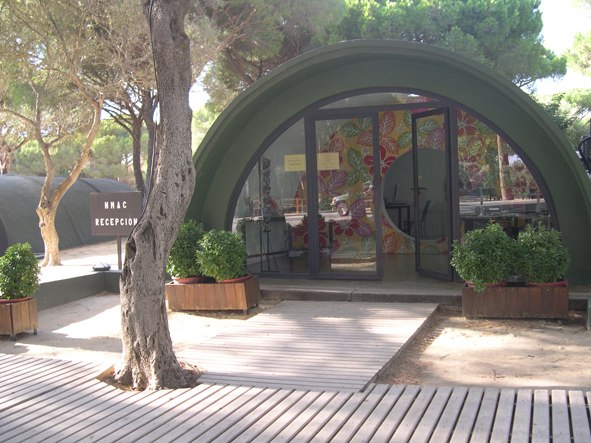 NMAC Foundation is a museum, which is situated 3½ km northwest of Lomas del Pericón.
Places in the Area
Nearby places include Barbate and Vejer de la Frontera.
Barbate
Town

Photo: Technische Fred, CC BY-SA 3.0.
Barbate is a Spanish municipality in the Province of Cádiz, in the autonomous community of Andalusia. It is a coastal town located on the shores of the Atlantic Ocean, close to the Strait of Gibraltar. Barbate is situated 4½ km southwest of Lomas del Pericón.
Vejer de la Frontera
Town

Photo: Dietmar Giljohann, CC BY-SA 3.0.
Vejer de la Frontera is a Spanish hilltop town and municipality in the province of Cádiz, Andalusia, on the right bank of the river Barbate. The town of Vejer de la Frontera occupies a low hill overlooking the Straits of Gibraltar and surrounded by orchards and orange groves. Vejer de la Frontera is situated 8 km northwest of Lomas del Pericón.
Zahara de los Atunes
Village

Photo: Killeando, CC BY-SA 3.0.
Zahara de los Atunes is a village on the Costa de la Luz of Spain in the province of Cádiz and the autonomous region of Andalusia. It is noted for its excellent beaches, an outdoor cinema, and la Iglesia Del Carmen church where, curiously, tuna were butchered and salted. Zahara de los Atunes is situated 10 km south of Lomas del Pericón.
Lomas del Pericón
Latitude
36.21933° or 36° 13′ 10″ northLongitude
-5.88525° or 5° 53′ 7″ westOpen location code
8C8P6497+PVOpenStreetMap ID
node 1241874362OpenStreetMap feature
place=locality
This page is based on OpenStreetMap, Wikidata, and Wikimedia Commons.
We’d love your help improving our open data sources. Thank you for contributing.
Satellite Map
Discover Lomas del Pericón from above in high-definition satellite imagery.
Localities in the Area
Explore places such as La Cortadura and El Portichuelo.
Notable Places Nearby
Highlights include Montenmedio Golf & Country Club and Biblioteca municipal.
Cádiz: Must-Visit Destinations
Delve into Cádiz, Jerez de la Frontera, Algeciras, and Tarifa.
Curious Localities to Discover
Uncover intriguing localities from every corner of the globe.
About Mapcarta. Data © OpenStreetMap contributors and available under the Open Database License". Text is available under the CC BY-SA 4.0 license, except for photos, directions, and the map. Photo: Wikimedia, CC0.