Rancho de Garbín
Rancho de Garbín is a locality in Algodonales, Cádiz, Andalusia. Rancho de Garbín is situated nearby to the locality Cerro de la Arena, as well as near Sosa.| Tap on a place to explore it |
Places in the Area
Nearby places include Puerto Serrano and Coripe.
Puerto Serrano
Village

Photo: El Pantera, CC BY-SA 4.0.
Puerto Serrano is a municipality in the province of Cádiz, Spain. In 2023 the municipality had a population of 6,921 inhabitants. Puerto Serrano is situated 6 km west of Rancho de Garbín.
Coripe
Village

Photo: El Pantera, CC BY-SA 4.0.
Coripe is a city located in the province of Seville, Spain. According to the 2006 census, the city has a population of 1,436. Coripe is situated 6 km northeast of Rancho de Garbín.
Algodonales
Village
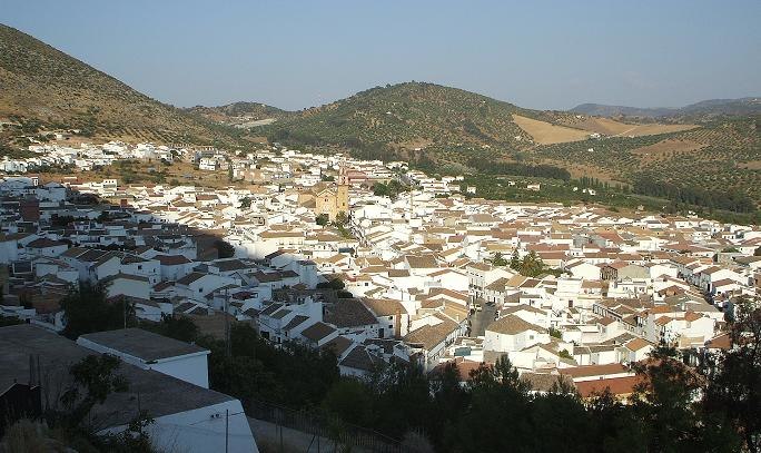
Photo: SergioBCN, Public domain.
Algodonales is a city and a Municipality, located in the province of Cádiz, Spain. According to the 2002 census, the city has a population of 5,607 inhabitants. Algodonales is situated 9 km southeast of Rancho de Garbín.
Rancho de Garbín
- Type: Locality
- Location: Algodonales, Cádiz, Andalusia, Spain, Iberia, Europe
- View on OpenStreetMap
Latitude
36.92959° or 36° 55′ 47″ northLongitude
-5.4784° or 5° 28′ 42″ westOpen location code
8C8PWGHC+RJOpenStreetMap ID
node 1241901252OpenStreetMap feature
place=locality
This page is based on OpenStreetMap, Wikidata, and Wikimedia Commons.
We’d love your help improving our open data sources. Thank you for contributing.
Satellite Map
Discover Rancho de Garbín from above in high-definition satellite imagery.
Localities in the Area
Explore places such as Cerro de la Arena and Sosa.
Notable Places Nearby
Highlights include cruz de la toleta and Ermita de Santa María Magdalena.
Cádiz: Must-Visit Destinations
Delve into Cádiz, Jerez de la Frontera, Algeciras, and Tarifa.
Curious Localities to Discover
Uncover intriguing localities from every corner of the globe.
About Mapcarta. Data © OpenStreetMap contributors and available under the Open Database License". Text is available under the CC BY-SA 4.0 license, except for photos, directions, and the map. Photo: Wikimedia, CC0.