Salto y Carta
Salto y Carta is a locality in Santaella, Córdoba, Andalusia. Salto y Carta is situated nearby to the locality La Añoreta, as well as near El Cañuelo.| Tap on a place to explore it |
Places of Interest
Highlights include Castillo.

Places in the Area
Nearby places include Santaella and La Guijarrosa.
Santaella
Village

Photo: Hameryko, CC BY-SA 4.0.
Santaella is a municipality located in the province of Córdoba, Spain. According to the 2024 census, the village has a population of 4655 inhabitants.
La Guijarrosa
Village
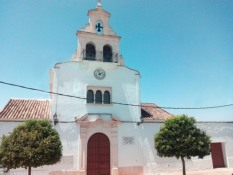
Photo: Hameryko, CC BY-SA 4.0.
La Guijarrosa is a municipality located in the Province of Córdoba, in the autonomous community of Andalusia, Spain. It was an independent local entity within the municipality of Santaella, until 2018 when it was constituted as an independent municipality. La Guijarrosa is situated 7 km northwest of Salto y Carta.
San Sebastián de los Ballesteros
Village

Photo: 19Tarrestnom65, CC BY-SA 4.0.
San Sebastián de los Ballesteros is a municipality located in the province of Córdoba, Spain. According to the 2006 census, the city has a population of 836 inhabitants. San Sebastián de los Ballesteros is situated 8 km north of Salto y Carta.
Salto y Carta
Latitude
37.5816° or 37° 34′ 54″ northLongitude
-4.83585° or 4° 50′ 9″ westOpen location code
8C9QH5J7+JMOpenStreetMap ID
node 1241916606OpenStreetMap feature
place=locality
This page is based on OpenStreetMap, Wikidata, and Wikimedia Commons.
We’d love your help improving our open data sources. Thank you for contributing.
Satellite Map
Discover Salto y Carta from above in high-definition satellite imagery.
Localities in the Area
Explore places such as La Añoreta and El Cañuelo.
Notable Places Nearby
Highlights include Iglesia de Nuestra Señora de la Asunción and Plaza Mayor.
Córdoba: Must-Visit Destinations
Delve into Córdoba, Puente Genil, and Iznájar.
Curious Localities to Discover
Uncover intriguing localities from every corner of the globe.
About Mapcarta. Data © OpenStreetMap contributors and available under the Open Database License". Text is available under the CC BY-SA 4.0 license, except for photos, directions, and the map. Photo: Mitch Vander Vorst, CC BY 2.0.