Cañada de Gregorio
Cañada de Gregorio is a locality in Córdoba, Córdoba, Andalusia. Cañada de Gregorio is situated nearby to the locality Domingón, as well as near Cuesta del Lobo.| Tap on a place to explore it |
Places of Interest
Highlights include Torre de Don Lucas.

Places in the Area
Nearby places include La Victoria and La Carlota.
La Victoria
Village

Photo: Cordoman, CC BY-SA 4.0.
La Victoria is a municipality in the province of Córdoba, Spain. In the year 2011 its population was 2,336. It has an area of 20 square kilometres and a population density of 120/km2.
La Carlota
Village

Photo: CFA1877, CC BY-SA 4.0.
La Carlota is a municipality of small settlements, in the southern half of Spain near Córdoba. In 2005 it had 11,488 inhabitants, and in 2018 just over 14,000, all living in a predominantly rural area measuring some 80 square kilometres. La Carlota is situated 5 km west of Cañada de Gregorio.
La Guijarrosa
Village
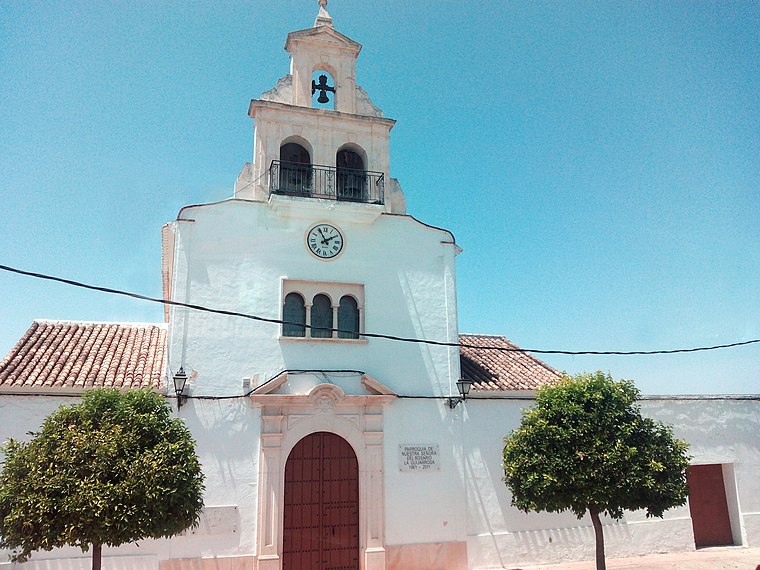
Photo: Hameryko, CC BY-SA 4.0.
La Guijarrosa is a municipality located in the Province of Córdoba, in the autonomous community of Andalusia, Spain. It was an independent local entity within the municipality of Santaella, until 2018 when it was constituted as an independent municipality. La Guijarrosa is situated 5 km south of Cañada de Gregorio.
Cañada de Gregorio
Latitude
37.68591° or 37° 41′ 9″ northLongitude
-4.87653° or 4° 52′ 36″ westOpen location code
8C9QM4PF+99OpenStreetMap ID
node 1241936039OpenStreetMap feature
place=locality
This page is based on OpenStreetMap, Wikidata, and Wikimedia Commons.
We’d love your help improving our open data sources. Thank you for contributing.
Satellite Map
Discover Cañada de Gregorio from above in high-definition satellite imagery.
Localities in the Area
Explore places such as Domingón and Cuesta del Lobo.
Notable Places Nearby
Highlights include Plaza de Andalucía and Plaza del Pardito.
Curious Localities to Discover
Uncover intriguing localities from every corner of the globe.
About Mapcarta. Data © OpenStreetMap contributors and available under the Open Database License". Text is available under the CC BY-SA 4.0 license, except for photos, directions, and the map. Photo: Wikimedia, CC BY-SA 3.0.